Introduction
This is an abridged description of a trip to the USA in June 1999. The intention is to give a firsthand personal experience of how we, Brigitte and I, did get to and through the many National Parks in Colorado, Utah and Arizona with a mobilhome.
This time we booked everything in advance. The decision to make this trip came all of sudden because British Airways offered a return flight from Duesseldorf in Germany to Denver in Colorado via London for 500.00 Deutschmark.That's around 250.00 Euro in today's money. But you would not get this today anymore. We booked the first night's hotel in Denver including free transfer from the airport. What to do in Denver then? What about a mobilhome? We were also lucky to book one for four weeks for 100.00 Deutschmark per day. Another good deal.
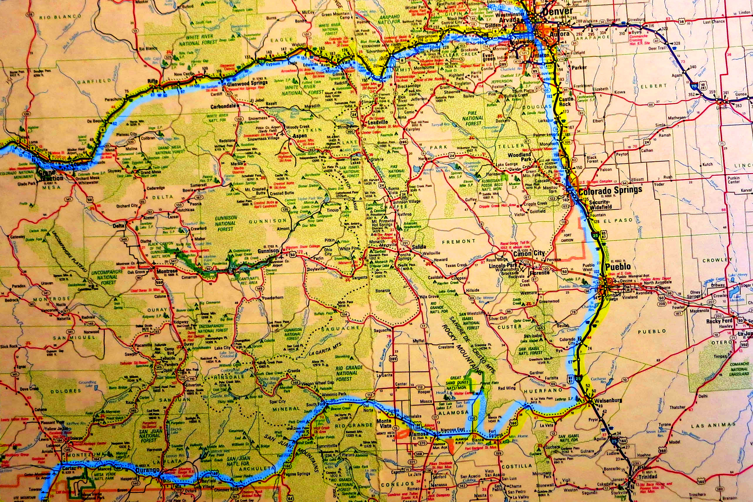
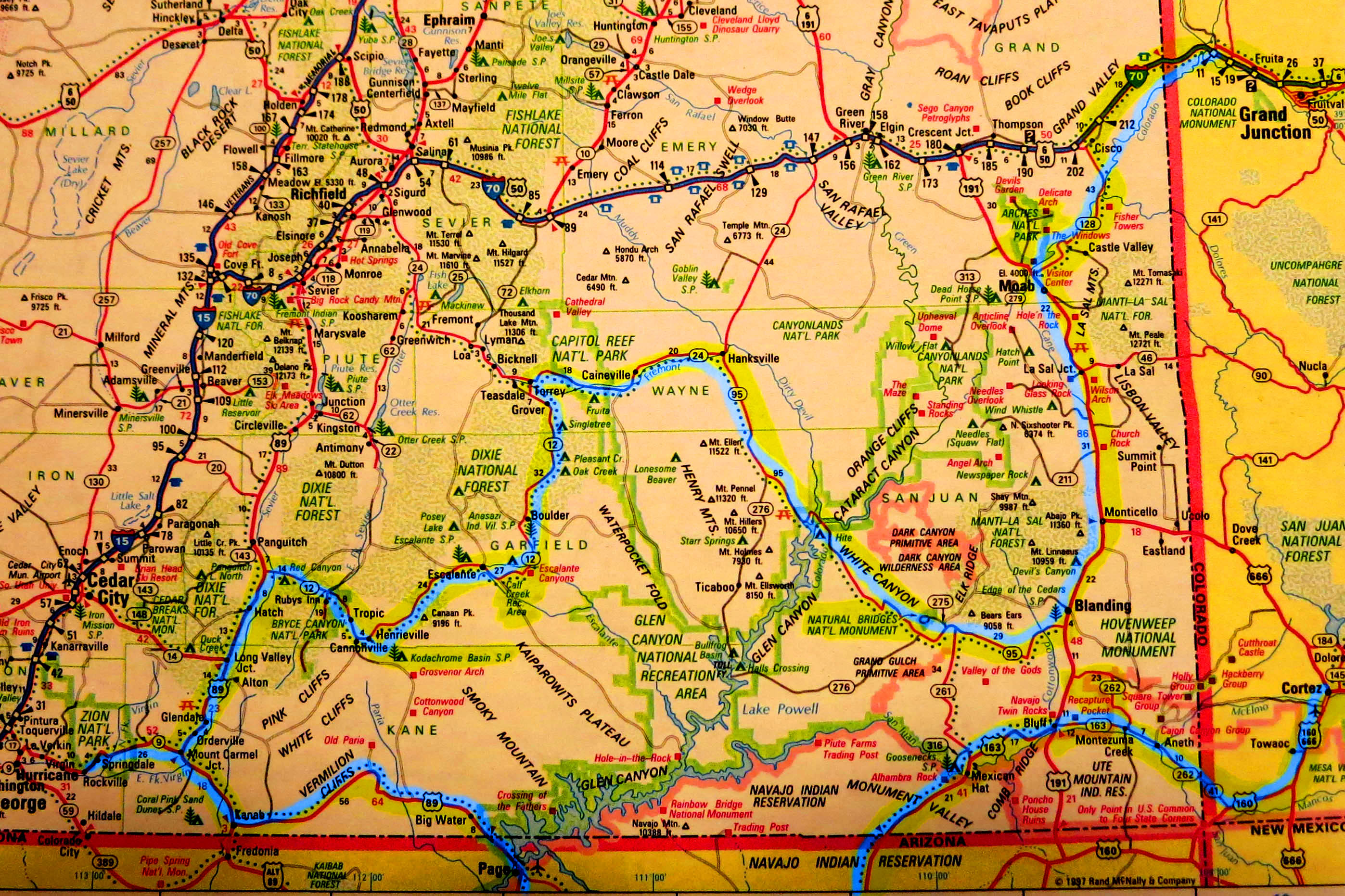
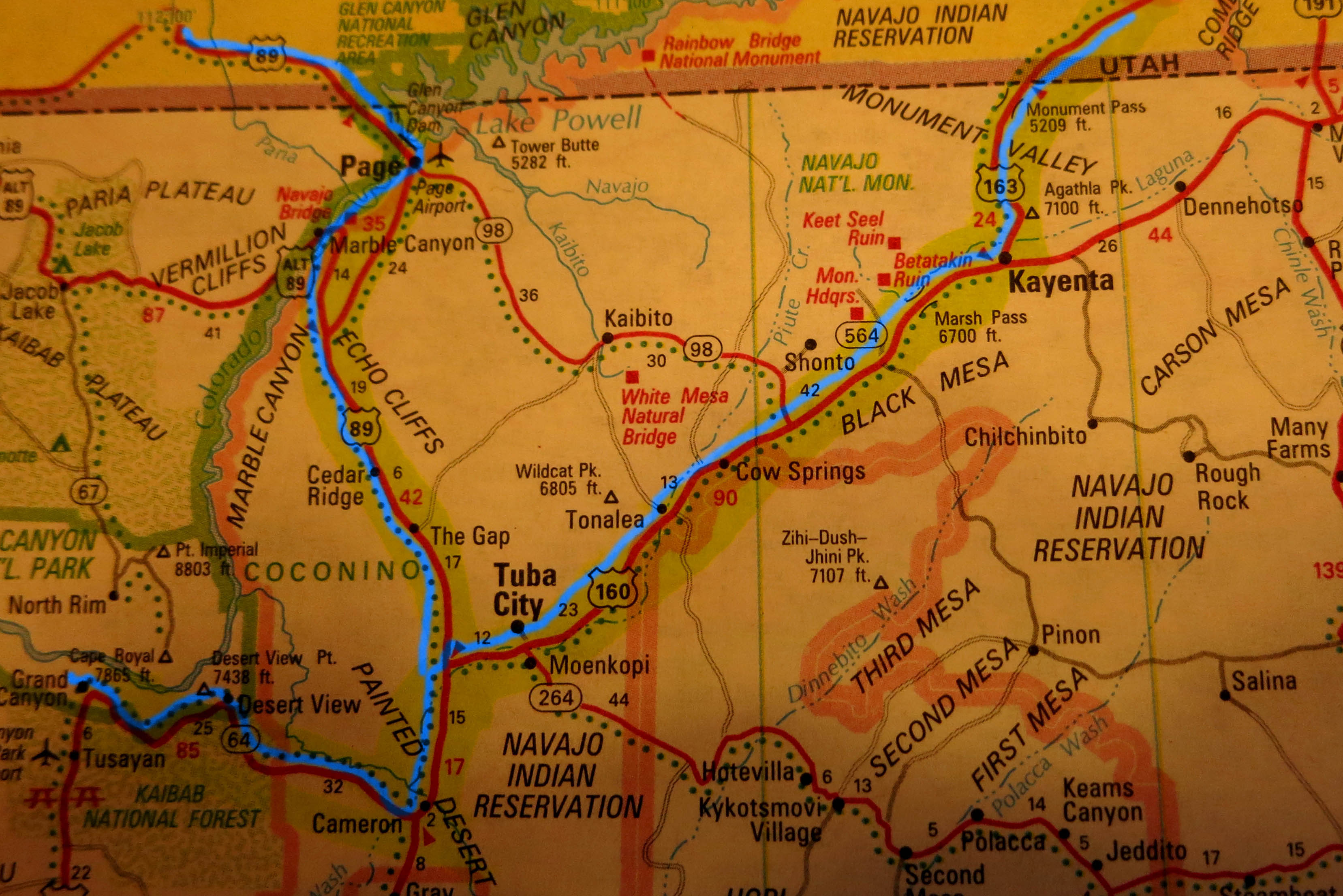
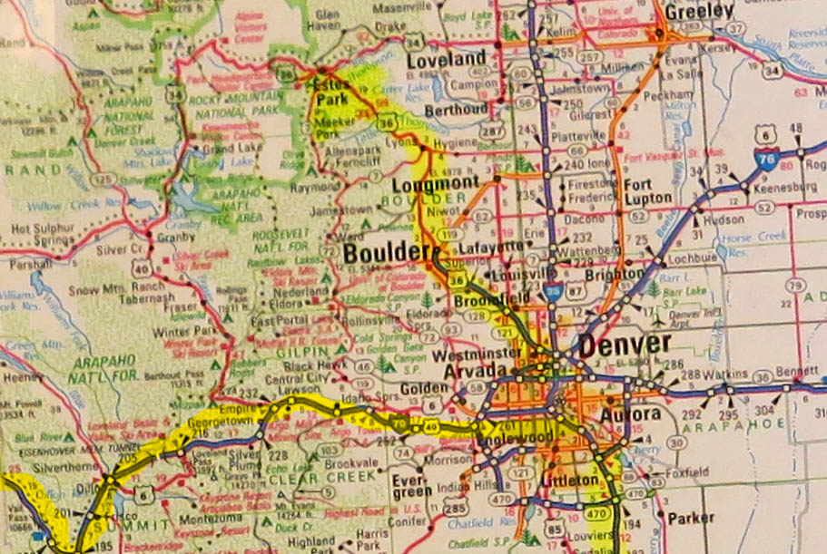
At the time of writing all this more than 18 years have passed. I tried to recall every place we have visited as good as I could. The itinerary is shown on the following maps as marked in blue or yellow.
 Copyright C 1997 by Rand McNally
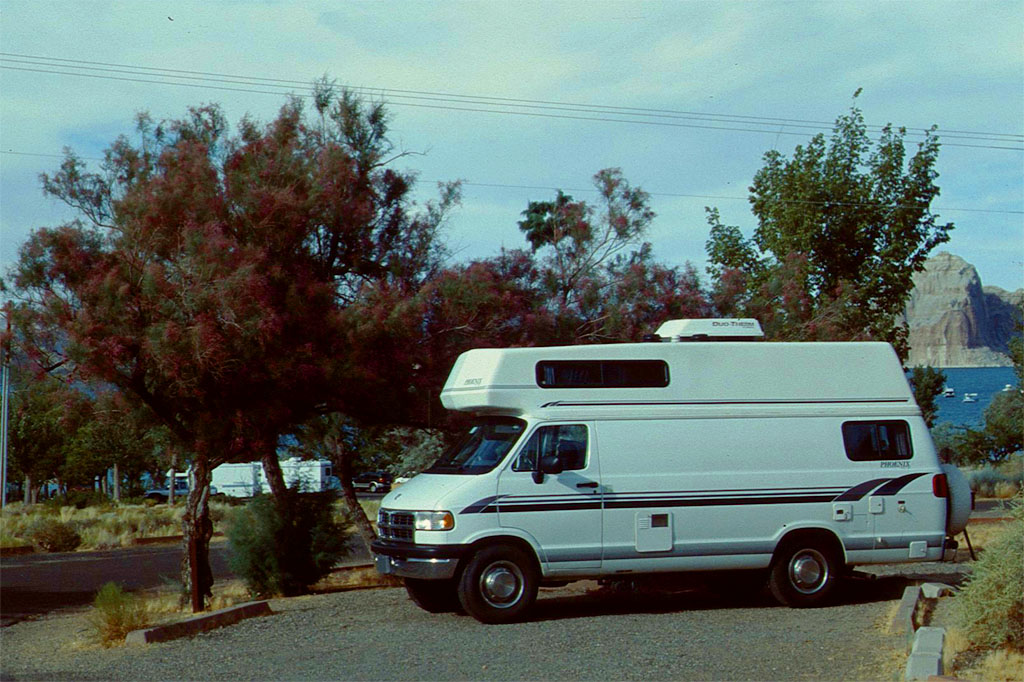
With a mobilhome we were independent and always self-supporter. It was big enough for us with two double beds, bathroom with shower, and a kitchen. So we didn't stay in motels or hotels except for the first and the last two nights.
Also we didn't eat in restaurants outside Denver. During the trip we always stayed overnight on either commercial or government campgrounds of the National Parks. Our food we bought at super markets on the way.
Denver
After we landed in Denver, the capital of the State of Colorado, we passed swiftly through passport control and customs. Then we were looking for the free shuttle bus of our hotel. But there was none. Later we found out that we had to call the hotel on arrival again. So we did get on a commercial shuttle bus, but that had difficulties to bring us to our pre-booked hotel, because they could not find it. After driving a while in circles we finally reached it.
Same day I walked to the city center of Denver in order to buy my supply of vitamins, minerals and certain hormones you only get in the USA without prescription. Brigitte was so exausted from the flight that she only could relax in the hotel.
Next day we went to the mobilhome rental station. What we didn't need for the trip we left in the suitcases and deposited them at that rental station. After getting all the instructions and papers we hit the road. Before we left Denver we bought at a super market whatever we thought we need to survive.
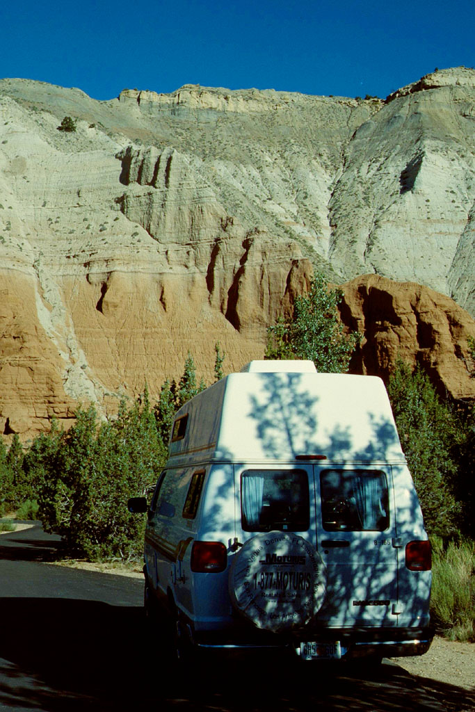
The following photos of Denver has been actually taken at the end of our trip. The first photo of our mobilhome comes next though. Most of the following photos are selfexplanatory. Most of them I just give the name of the place if I still remember. Look up the internet if you want to know more about it.
Click a small picture or a map to get it enlarged
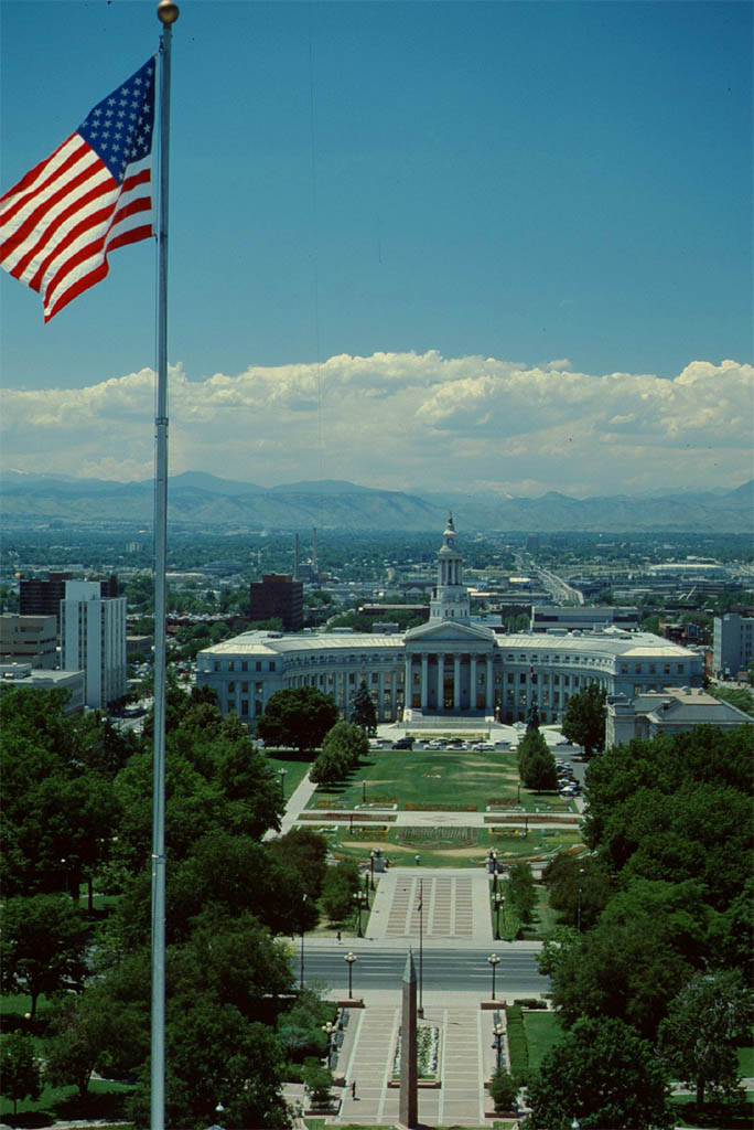
| The Capitol of Denver
|

| The city of Denver
|
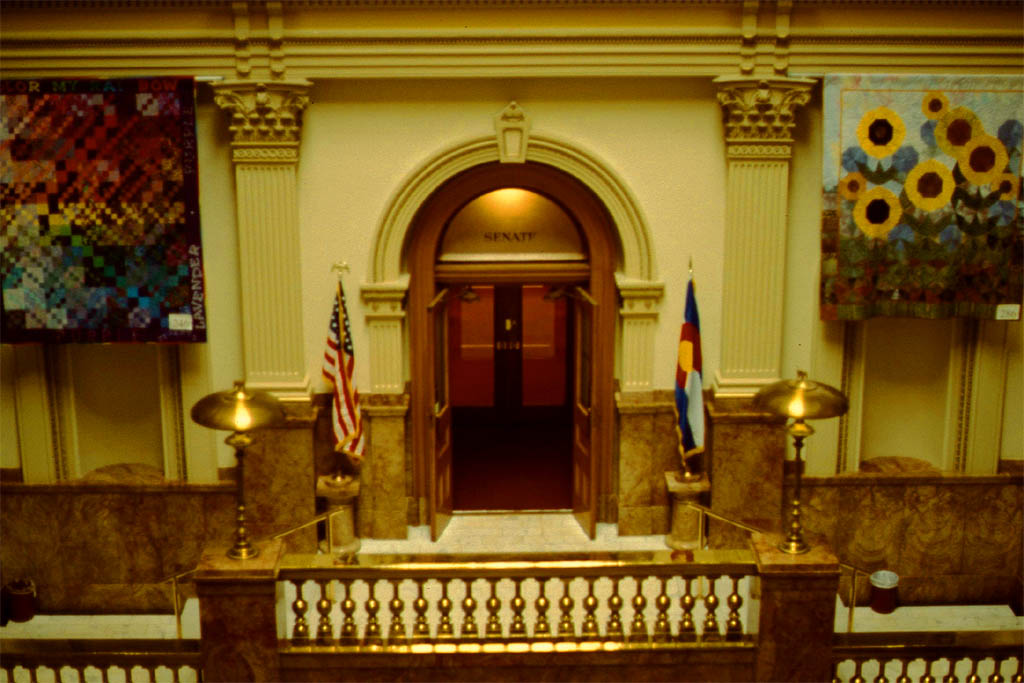
| Inside the Capitol of Denver
|
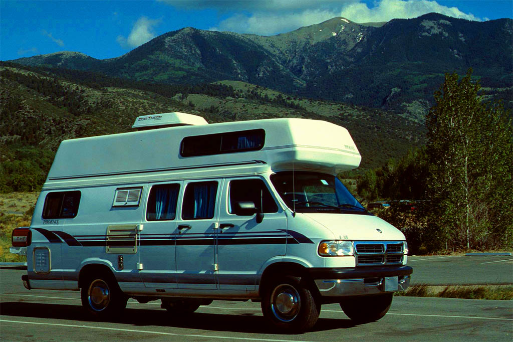
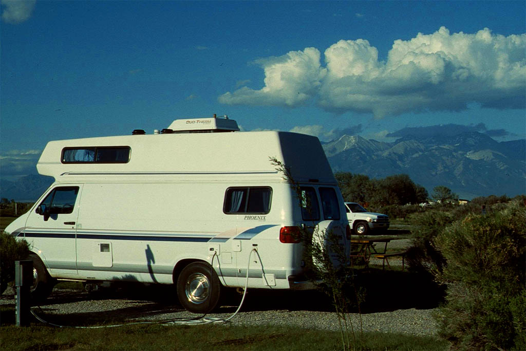
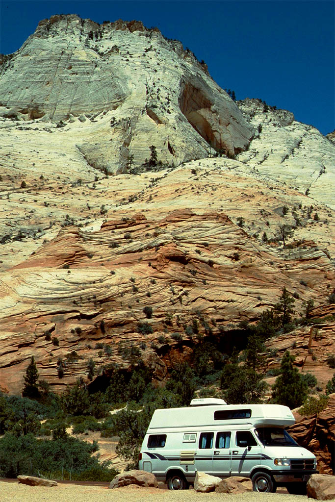
| Our Dodge mobilhome
|
Colorado Springs
The first day we didn't drive that far heading south on the Highway 25. I had made reservation of a commercial campground close to Colorado Springs, just to be on the safe side the first day. There I learned how to connect our mobilhome to an electricity outlet, a fresh water pipe and a sewage pipe for the waste water. I do not know the price but it would be much more different than today anyway.
 Copyright C 1997 by Rand McNally
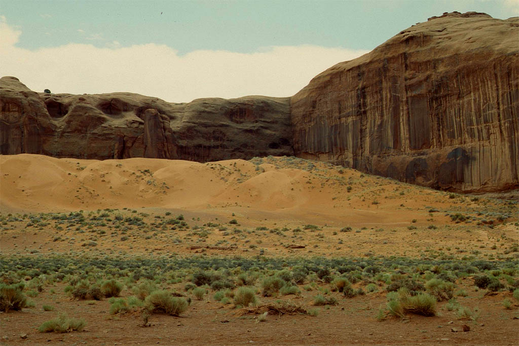
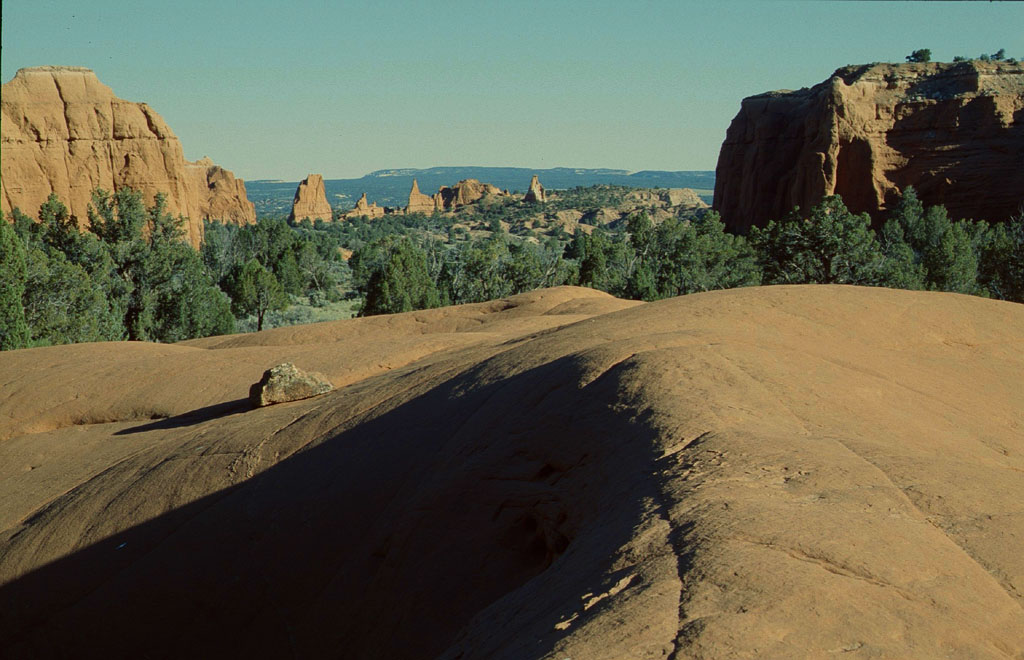
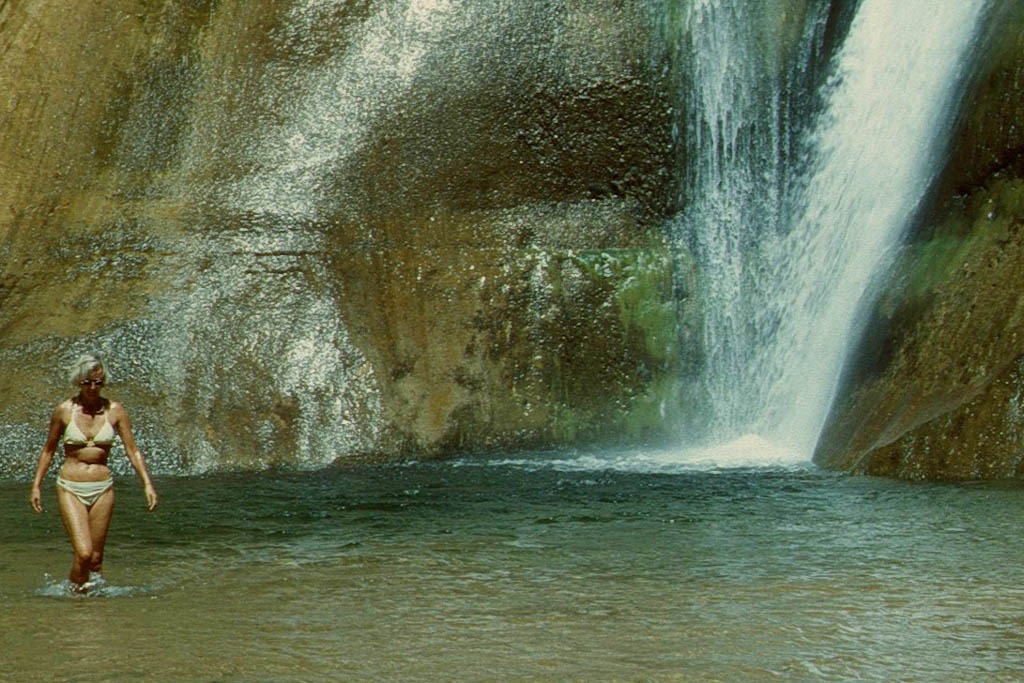
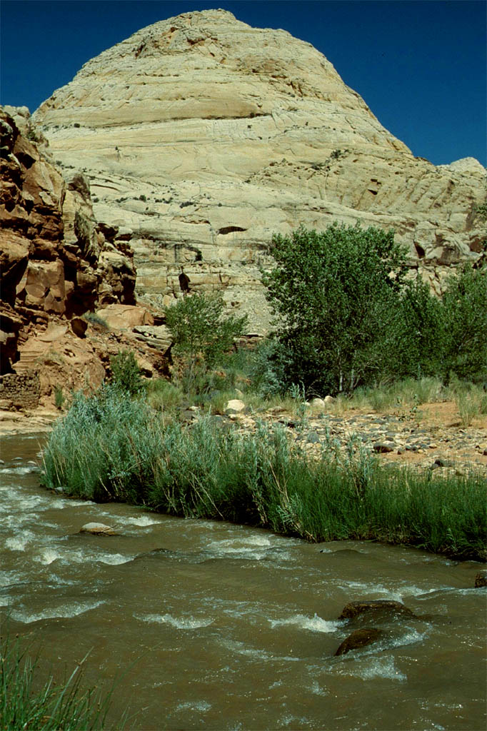
Sand Dunes National Monument
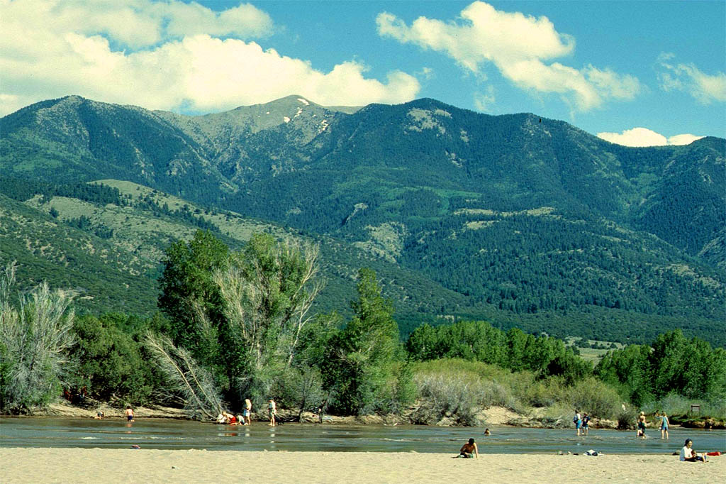
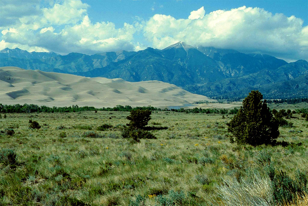
Next day we drove down south until we reached the intersection at Walsenburg where we turned west onto the Highway 160. At the Highway 150 we turned north to reach the Sand Dunes National Monument. What a nice place. It was like an oasis in the desert with real sand dunes. I felt like being in Morocco or Tunisia. I wished I could have stayed around here the night like some other mobilhomes but I had made reservation at another campground close-by.
So we just walked up and down and around and finally went back to the Highway 160 to continue to Alamosa where we stayed overnight on a commercial campground. That was the last time I made a reservation. From now I took a look first, because there were always lots available on our trip.
| Then we reached a beach at a river?
|

| No, it's the desert of the great Sand Dunes
|
| We could have stayed here
|
| but we had made reservation here
|
| Relaxing in the warm sun on that ugly campground
|
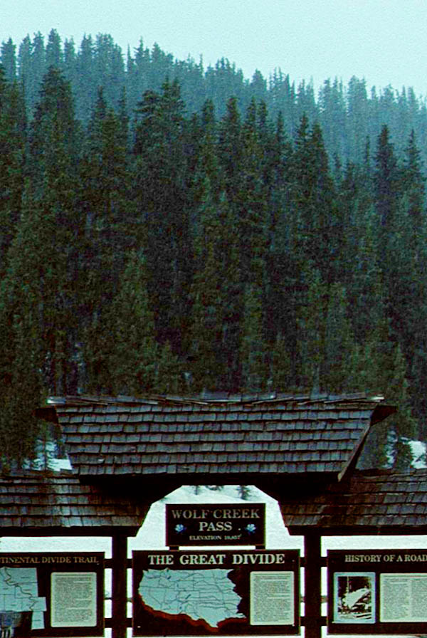
| before we hit the cold at the Great Divide on the Wolf Creek Pass
|
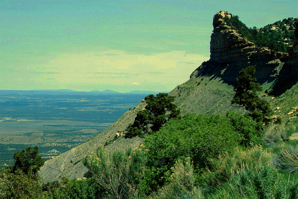
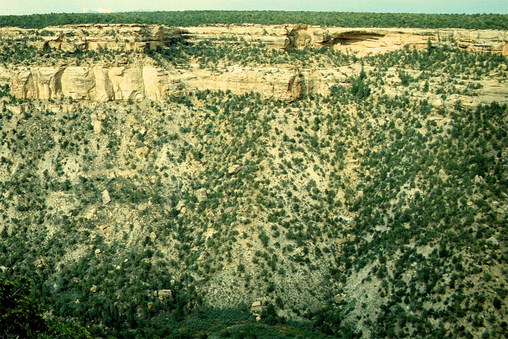
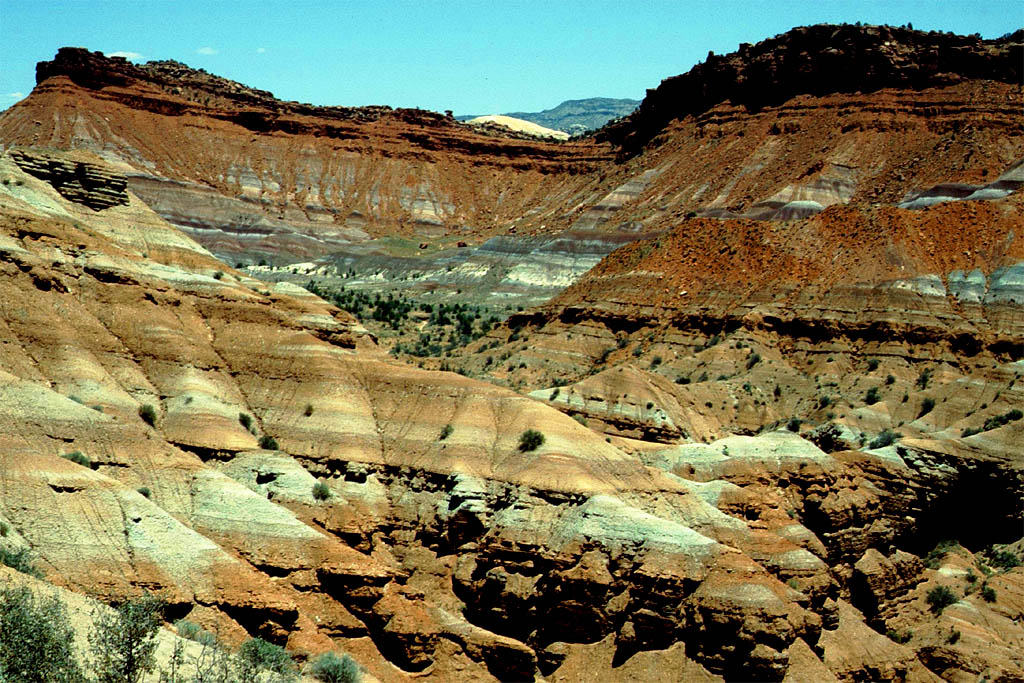
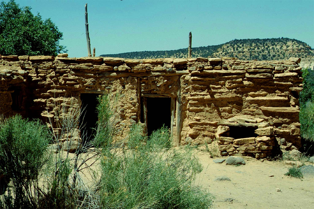
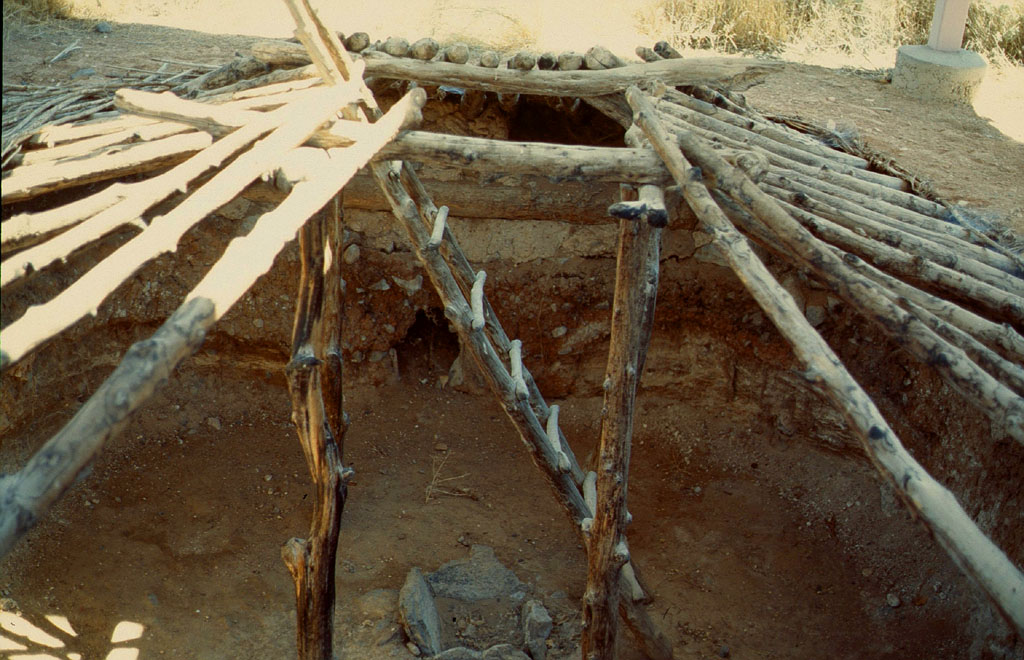
Mesa Verde National Park
We continued on Highway 160 until we reached Mesa Verde National Park.
Mesa Verde, Spanish for green table, offers a spectacular look into the lives of the Ancestral Pueblo people who made it their home for over 700 years, from AD 600 to 1300.
Here I think we bought the Eagle Pass for 50.00 USD which was then valid for most of the national parks we have visited on our tour. I do not remember that I have paid for another entry fee. That pass is valid for one car including all passengers. Now the pass is called "America the Beautiul Passes" and costs 80.00 USD according to www.nps.gov/planyourvisit/passes.
You can also look up all the information of the national parks we visited in the internet. Also the descriptions of the national park itself under their names. So now look up Mese Verde and you learn more about it.
| Down from the Rockies
|

| to Mesa Verde National Park
|

| The last Pueblo Indians
|
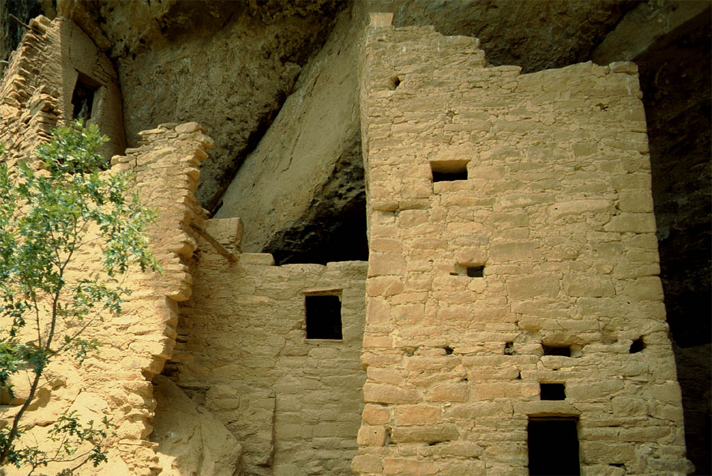
| left this place 700 years ago
|
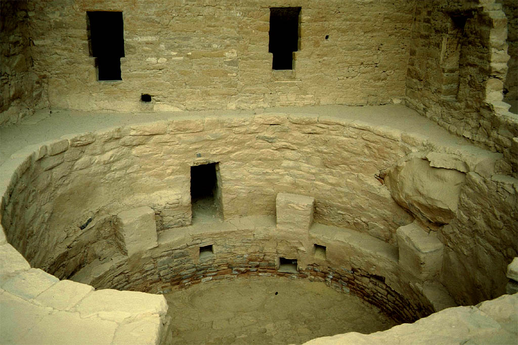
| An old Pueblo Indians gathering place
|
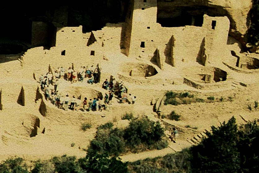
| Now a tourist group gathering point
|

| This looks like a market place
|
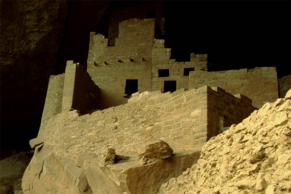
| And this a home like a castle
|
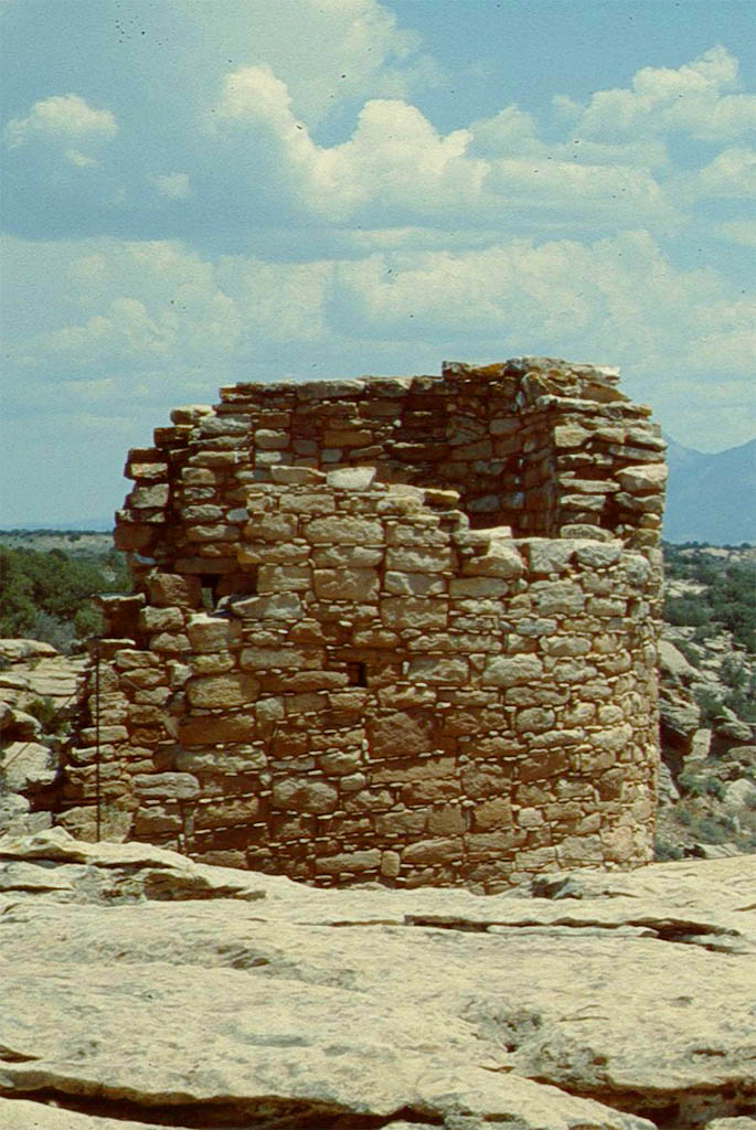
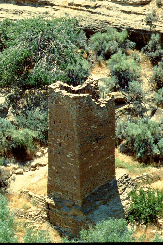
Hovenweep National Monument
We hit the Highway 160 again and then the Highway 262 until we cross the border to Utah. We continued until we reached the Hovenweep National Monument (somehow).
 Copyright C 1997 by Rand McNally
Hovenweep was once home to over 2,500 people. It includes six prehistoric villages built between A.D. 1200 and 1300. But why did the people leave? Nobody really knows.
Maybe drought combined with other calamities. Historians think that the people didn't die out but migrated to the south, either the Rio Grande Valley in New Mexico or the Little Colorado River Basin in Arizona, where the descendants continued to live as Zuni, Hopi and Pueblo Indians. By the way
| On the way to
|

| Hovenweep National Monument
|
| With old towers
|
| built by ancestral Puebloans
|
The Twin Rocks
Now we drove down the Highway 191 until we reached the Twin Rocks where we parked in front of the Twin Rock Trading Post. Here it happend that we did get a flat tyre. The guy of the Trading Post was very kind to call a car repair shop. Very quick the car mechanic arrived, took the wheel off, drove away, came back with the fixed tire, mounted it again. And the whole thing took less than an hour. That's American service.

| Next: the Twin Rocks close to Bluff in Utah
|

| where we had a flat tire (see the missing wheel)
|
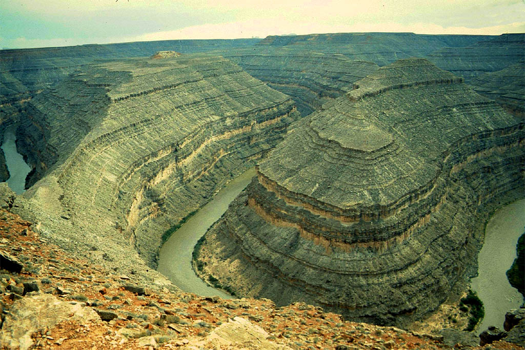
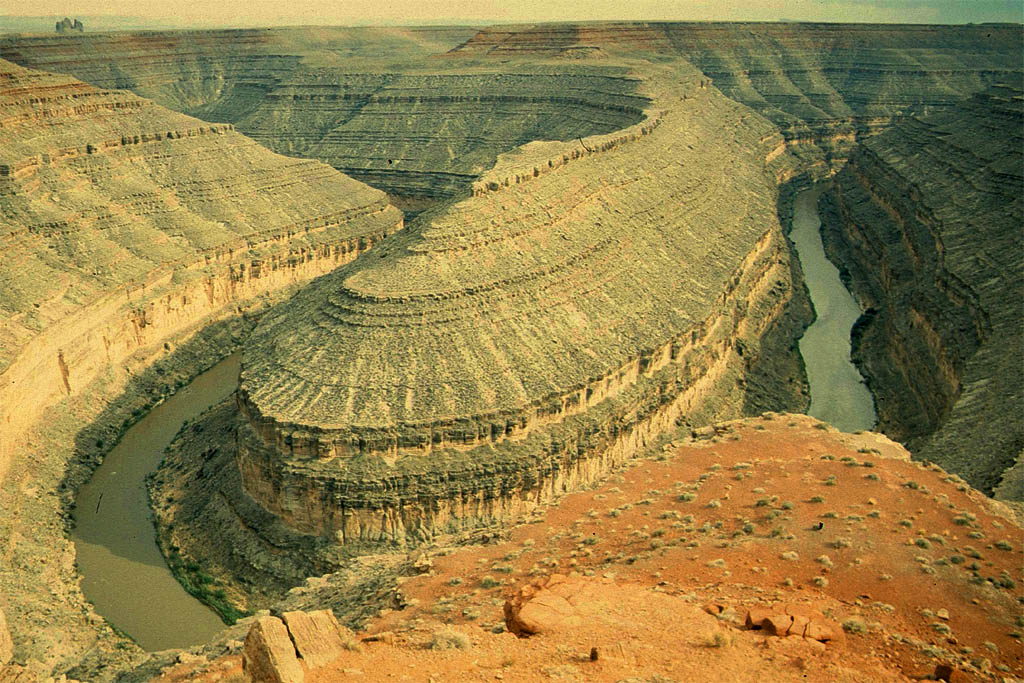
The Goosenecks State Park
We continued with our new vulcanized tire on the highway 163. Just before the Mexican Hat we made a side trip to the Gooseneck State Park.
What a sight. The San Juan River makes a series of tight turns - goosenecks - below this viewpoint. The river has carved a deep canyon here, dropping about 1,000 feet below the viewpoint. Geologists say this erosion has uncovered a rock record exposing some 300 million years of time.
| Next: the goosenecks of the San Juan River
|
| What a fantastic view
|
The Mexican Hat
After we visited the Gooseneck State Park we crossed the San Juan River to reach the Mexican Hat. This settlement is named after the rock which looks like a Mexican sombrero on top. If you got the time you could have joined a rafting trip from Bluff to the Mexican Hat, though not through the gooseneck but the river before that.
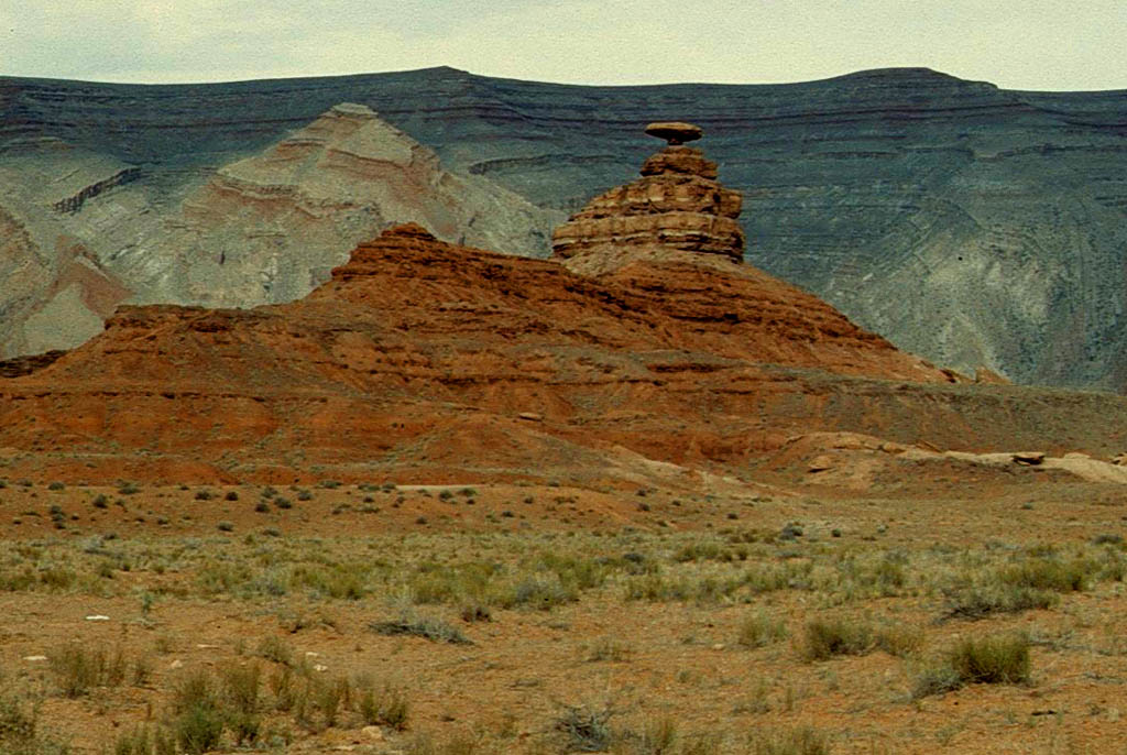
| Next: The Mexican Hat
|

| No gas but a taco at Taco Bell
|
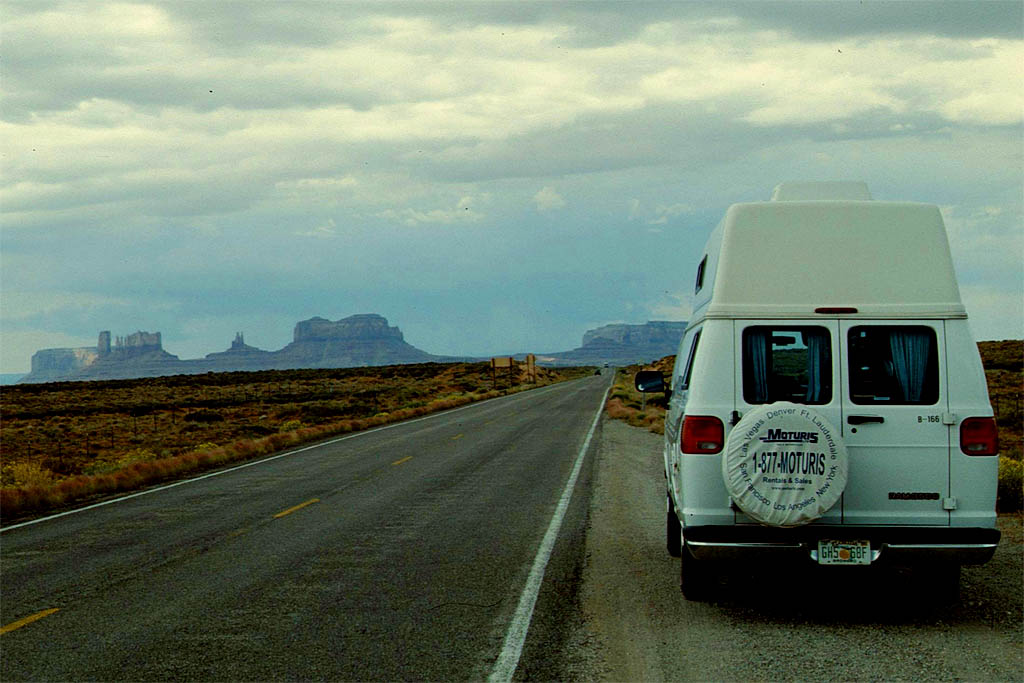
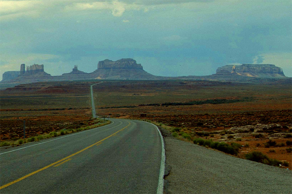
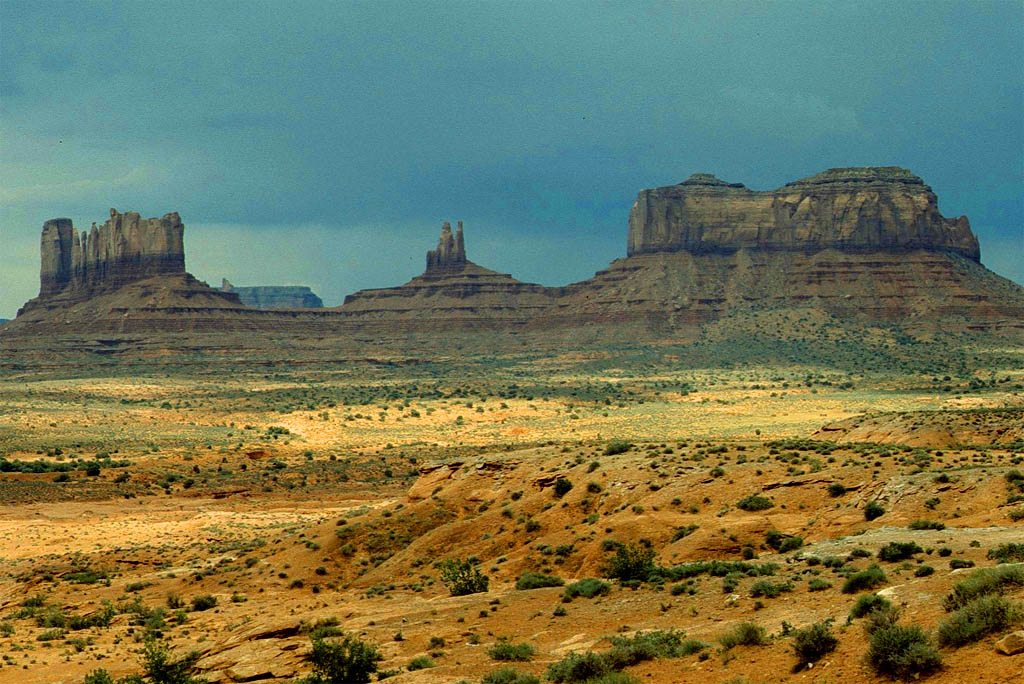
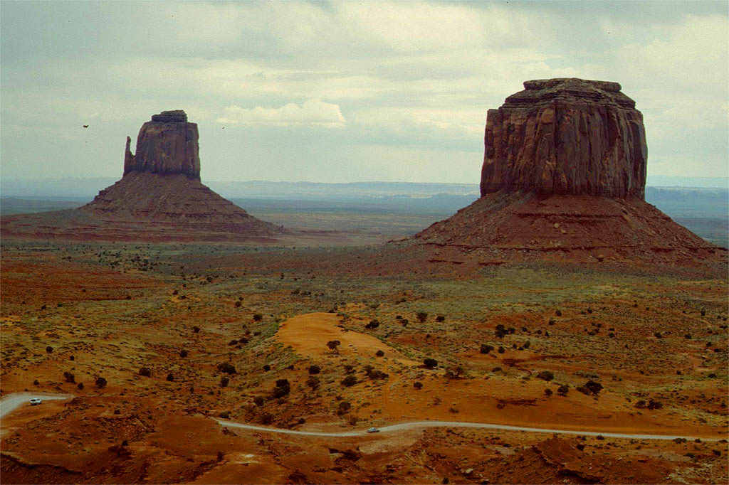
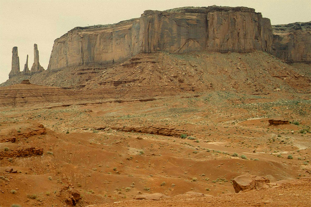
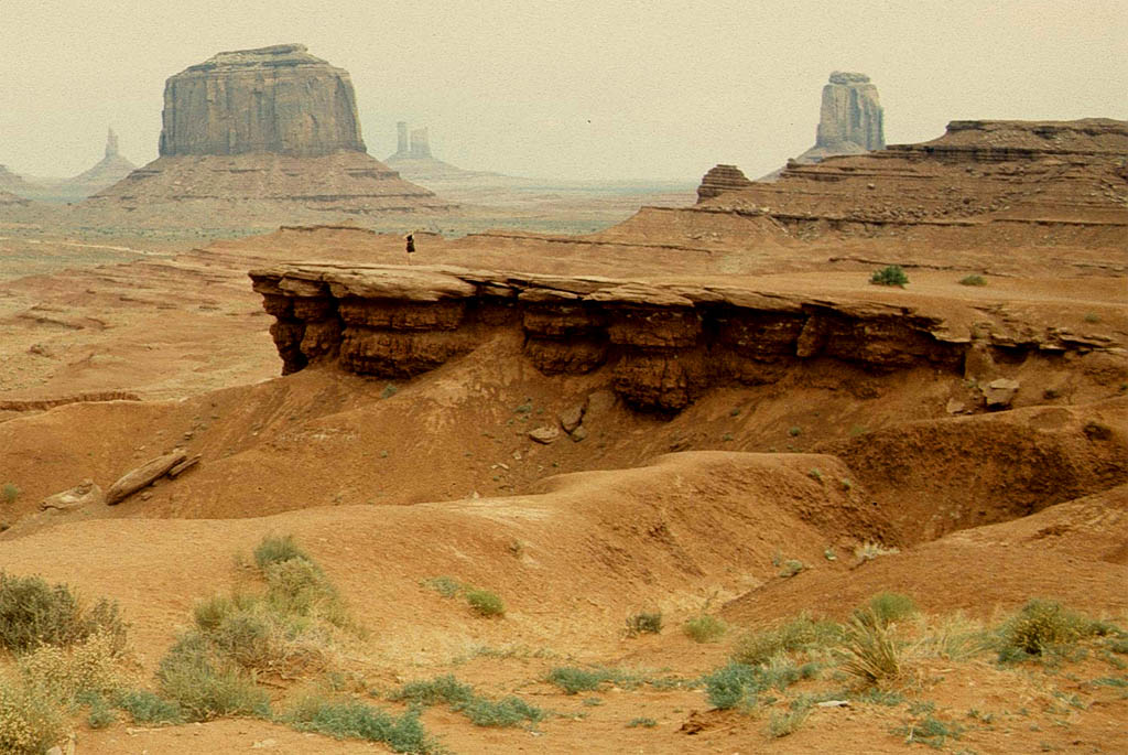
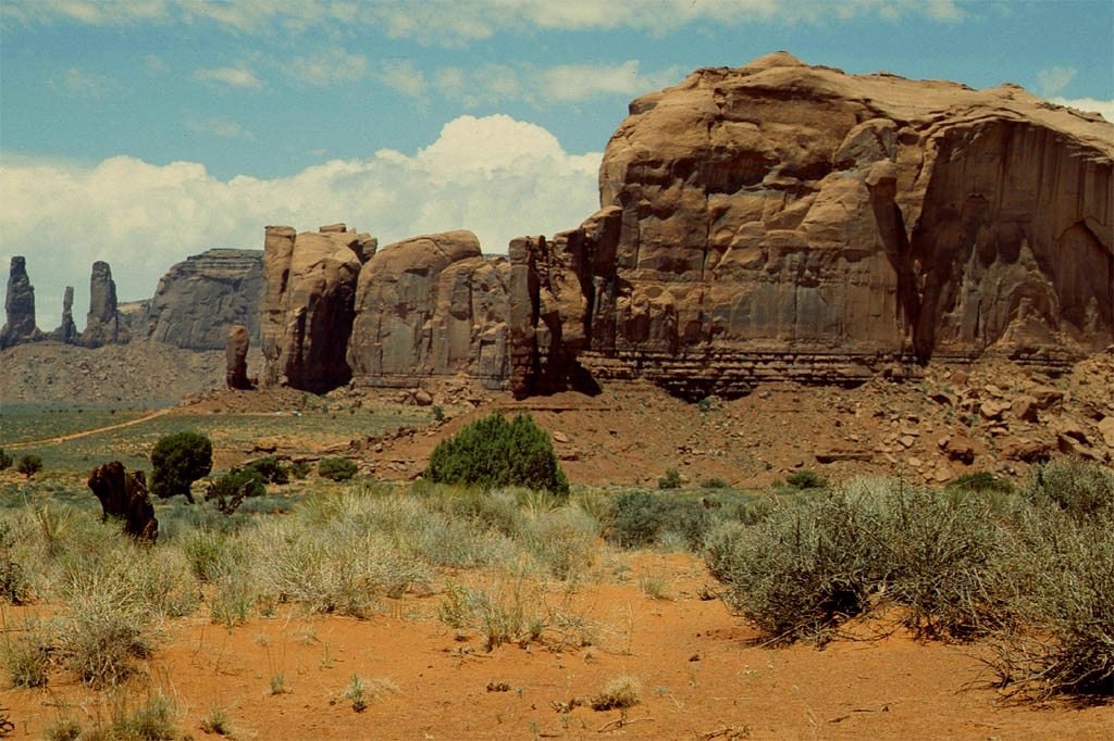
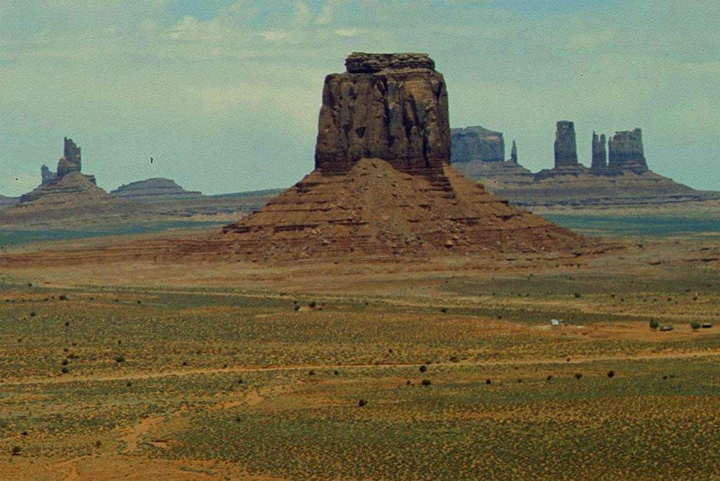
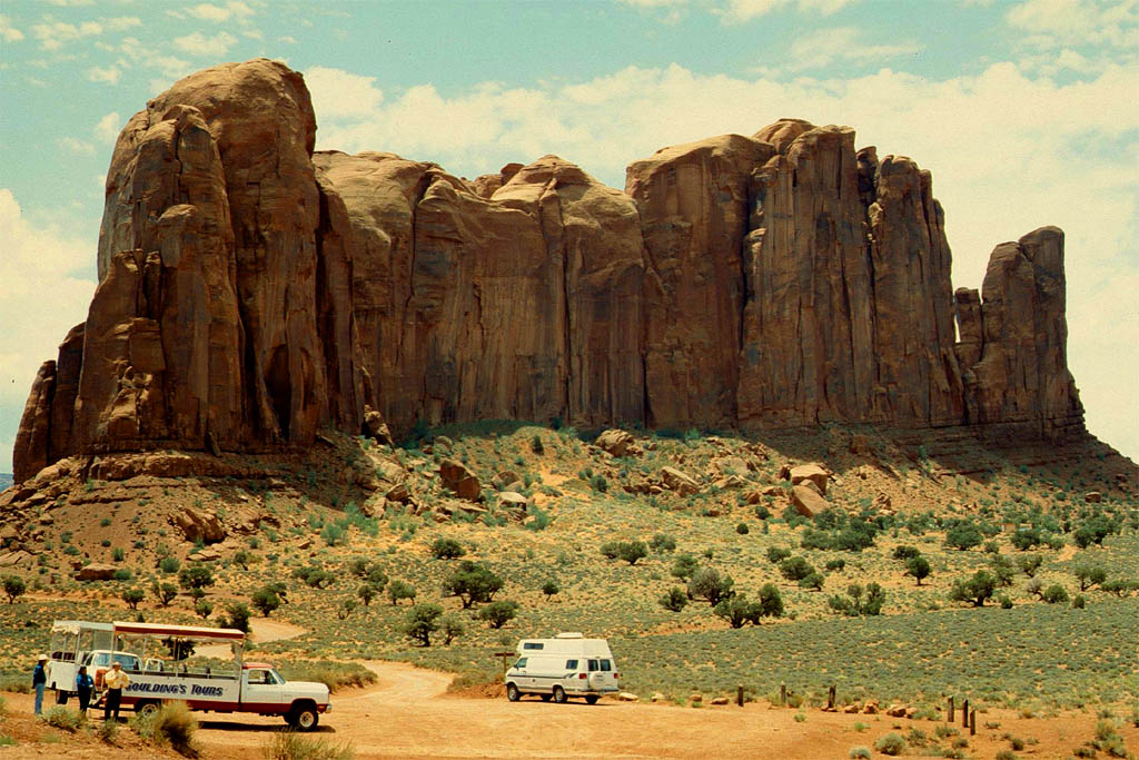
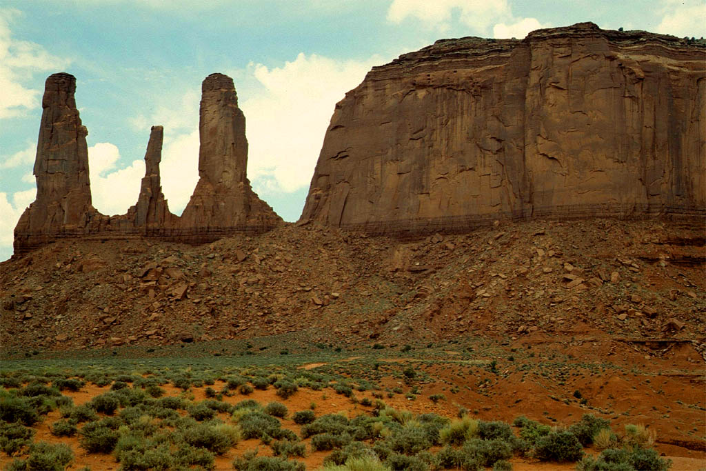
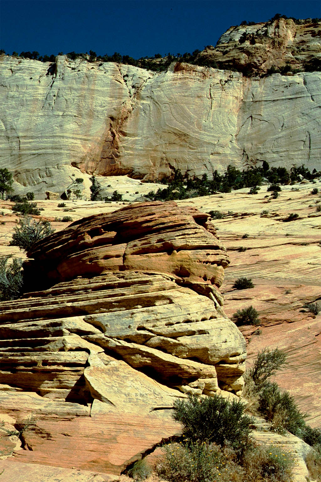
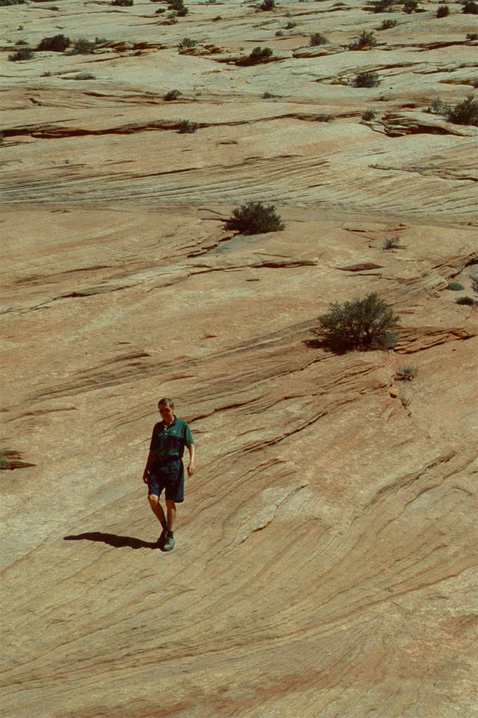
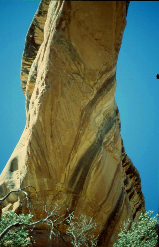
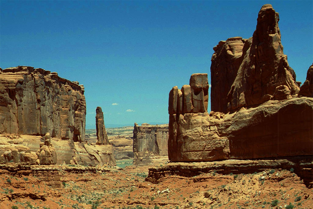
The Monument Valley
After staying overnight on a commercial campground in Mexican Hat we continued on the highway 163 leading through the Monument Valley, which actually lies within the Navajo Nation Reservation. Everybody knows these kind of landscape from the many Western Movies. I imagined John Wayne riding between those sandstone buttes .The largest are 300m high. Take a look at following photos and read the comments.
| Driving to Monument Valley
|
| Following strait the only road
|
| Getting closer
|
| Following the winding road
|
| Some monuments are already
|
| falling apart
|
| Only rocks, sand
|
| and gras
|
| We continue the road
|
| until we reach this parking lot
|

| From here we circled on a dirt road around
|
| which actually was not allowed by the rental station
|
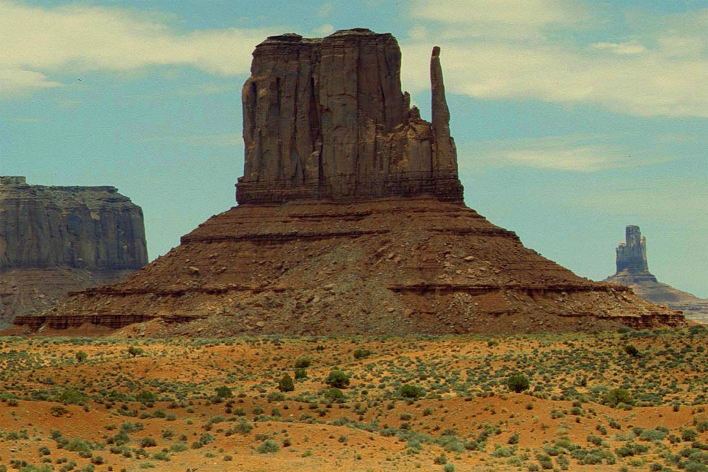
| But what the heck
|

| we wanted the best photo shot
|
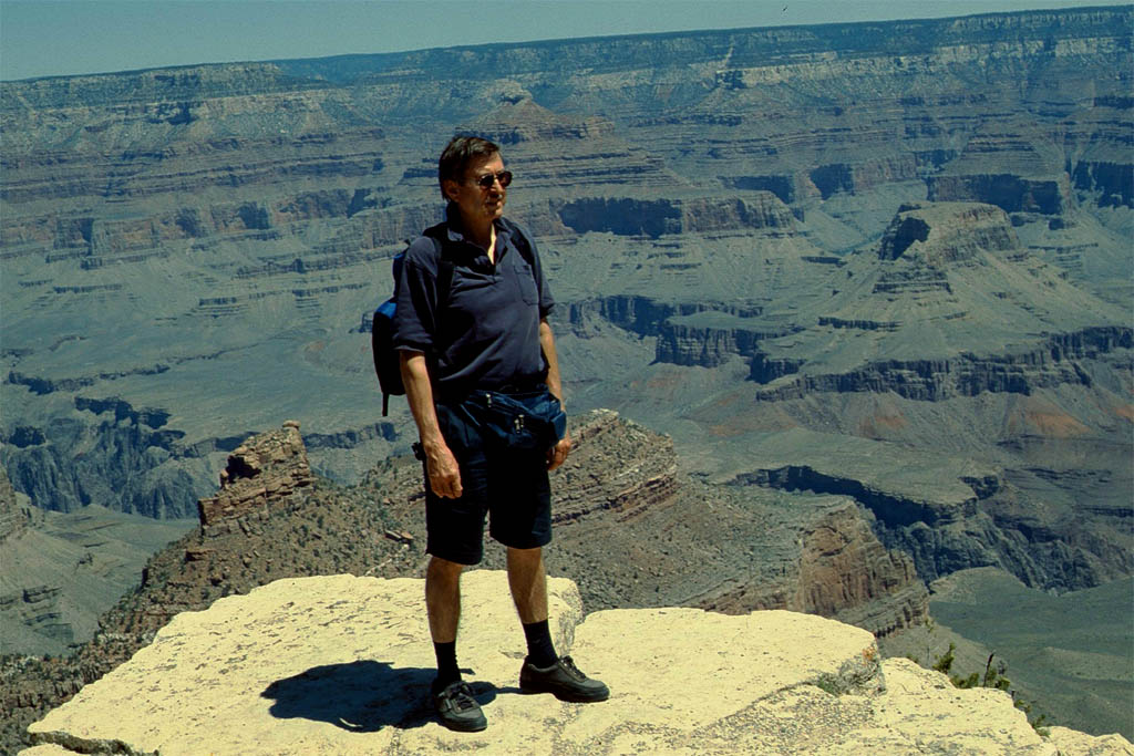
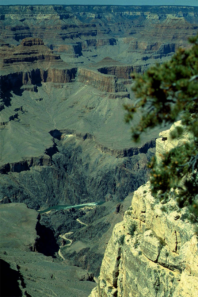
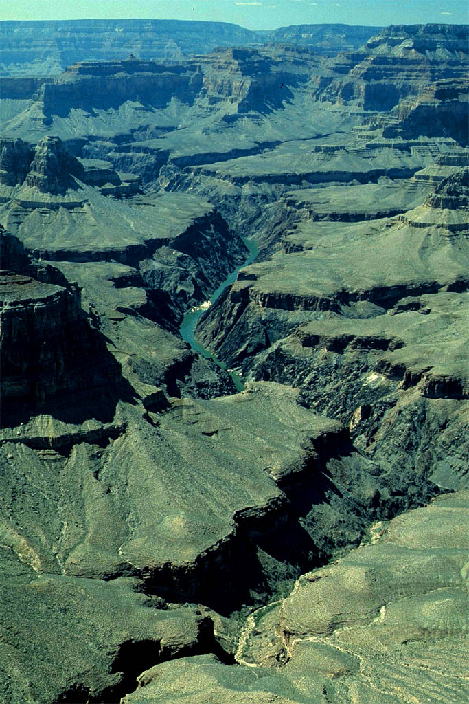
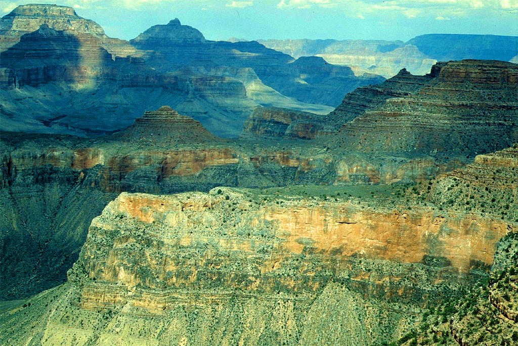
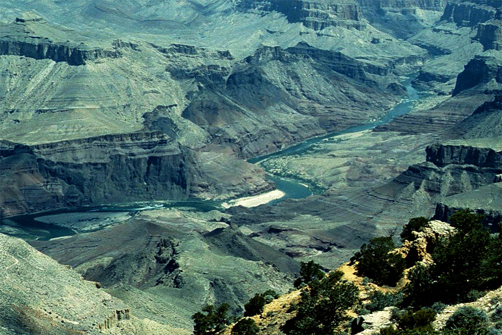
The Grand Canyon
We continued on the highway 163 until we hit the highway 160 at Kayenta. We followed that highway, also called the Navajo Trail, until we reached the highway 89 after passing Tuba City. Then we drove south and turned west at Cameron onto the highway 64, also called the Desert View Drive, which was leading us to the Grand Canyon National Park,
 Copyright C 1997 by Rand McNally
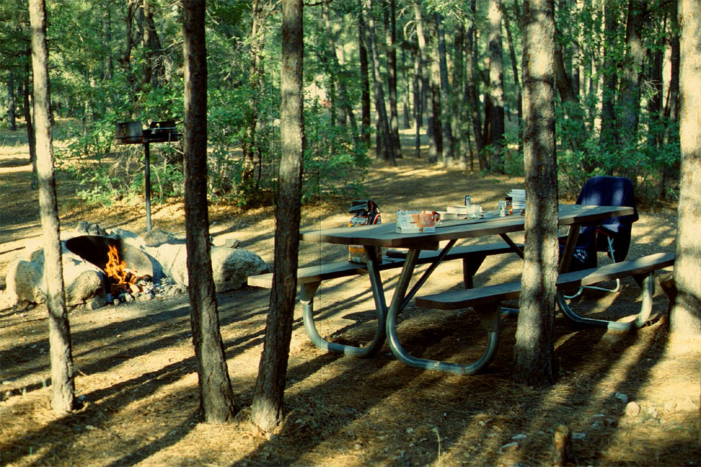
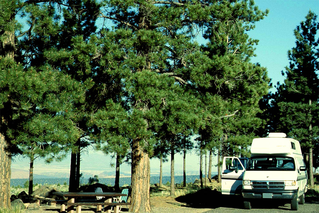
We didn't look into the canyon yet because we had to look for a national park campground, not a commercial one. We found a nice one south of the canyon.
At the entrance of that campground there was a board with boxes with numbers of the lots. Empty boxes meant a free lot. So keep note of the empty lot numbers then drive around to the marked lots. After have chosen the best one, you drive back and put 10.00 USD in a provided envelope and drop it in the box as an indication that the lot is now occupied.
Our chosen lot was very secluded in the forest. We hardly could see our next neighbor through the trees. We had a table, a bench and a fire place with a grill for barbecue. There were toilets but no showers though. If you want to make a fire you could just drop your money in a provided box and take a bunch of firewood from a pile close to the entrance. So it was a very good experience. It's all very well organized but also built on trust.
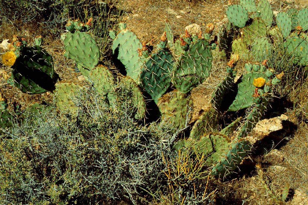
| Cactusses on the way
|
| to the campground in the Grand Canyon National Park
|
Even Park Rangers came around to ask you to join an introductory session, what we did.
Following is actually not what he told us but just an excerpt from Wikipedia:
The Grand Canyon is a famous canyon in Arizona, formed by the Colorado River. It is a UNESCO World Heritage Site and a National Park of the United States. It is also one of the Seven Natural Wonders of the World.
The Grand Canyon is 277 miles (446 km) long, up to 18 miles (29 km) wide and is over a mile (1.83 km) (6000 feet) deep in places. Nearly two billion years of the Earth's geological history have been exposed as the Colorado River and its tributaries cut their channels through layer after layer of rock while the Colorado Plateau was uplifted by tectonic action.
Evidence suggests the Colorado River established its course through the canyon at least 17 million years ago. Since that time, the Colorado River continued to erode and form the canyon to the point we see it at today.
And now let's have a real look.

| Yes, that's the
|

| Grand Canyon
|
| This is proof that I was here
|

| and looking down to the Colorado River
|

| We did take a path down
|
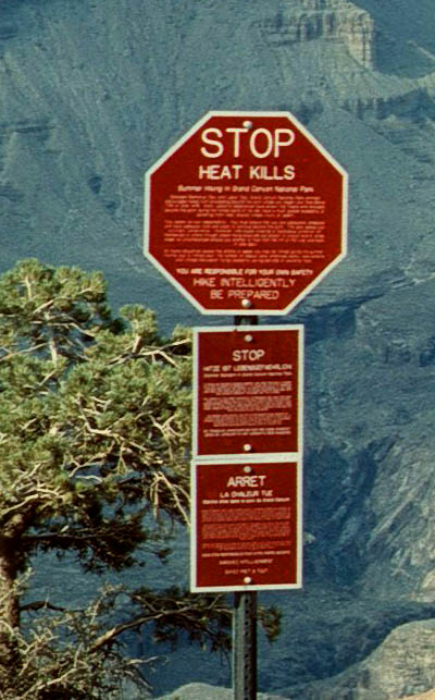
| until we reached this sign
|
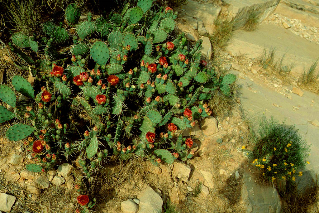
| The cactus can stand the heat
|
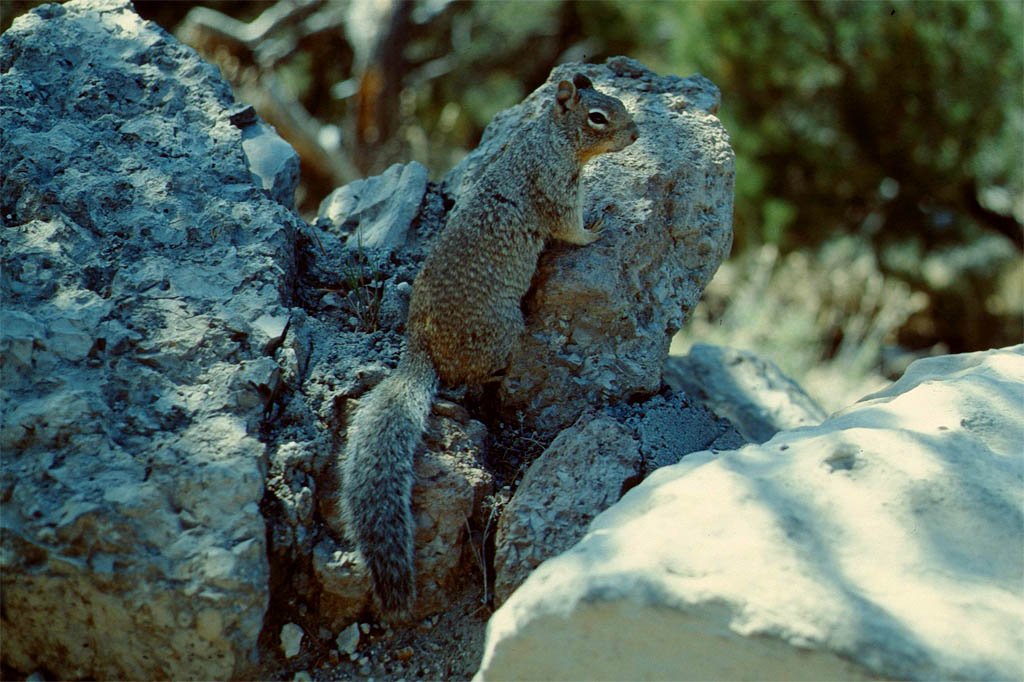
| But I don't know about this squirrel
|
| Last glimps down to the river
|
| before turning back from the stop sign
|
| Back on top
|

| Looking around from above
|
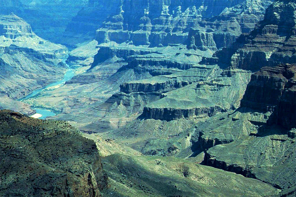
| Looking down to the river
|
| from another spot
|

| Different light in the late afternoon
|

| This really looks like a sun temple
|

| Last glimpses
|
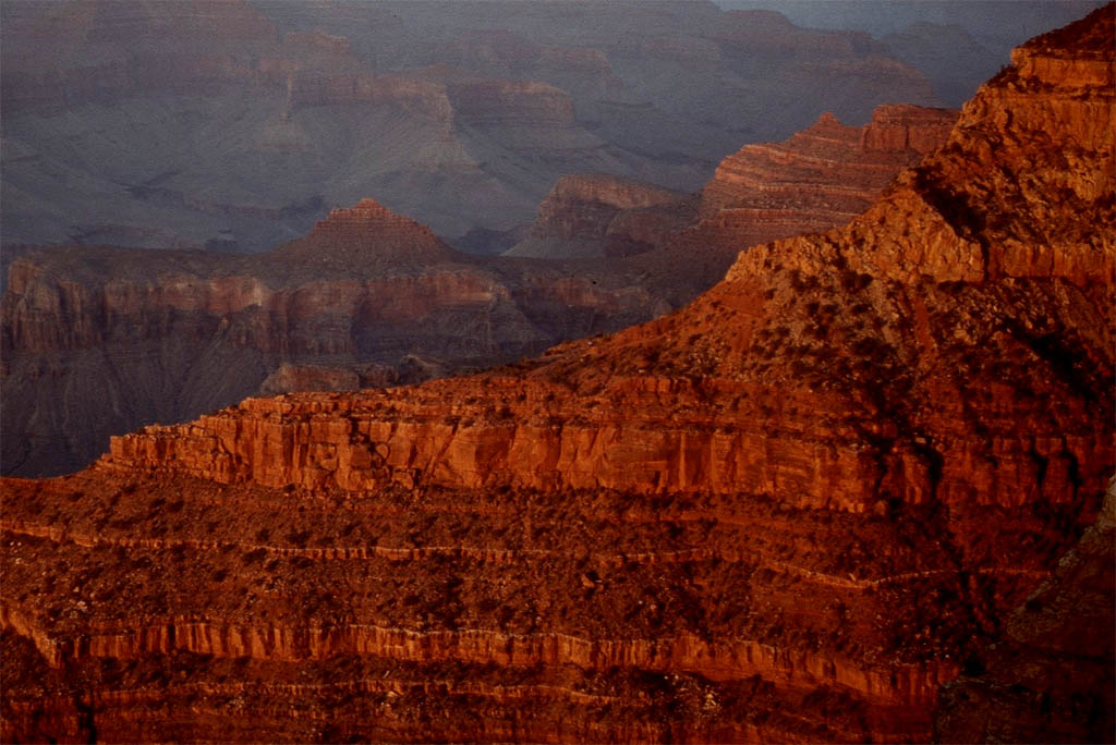
| of the final sun set
|
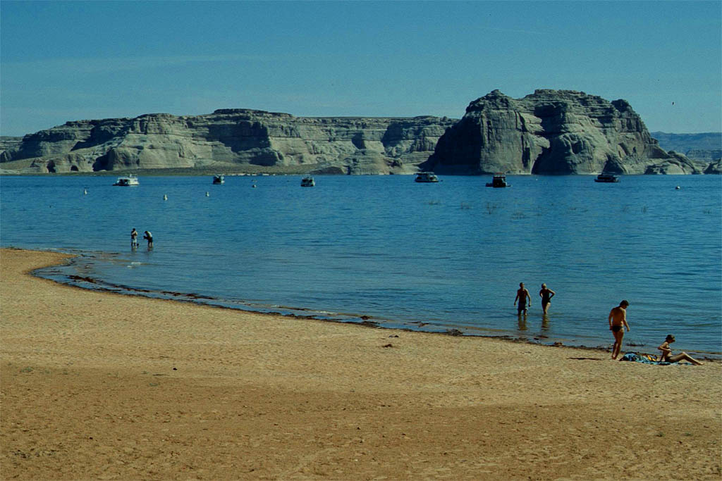
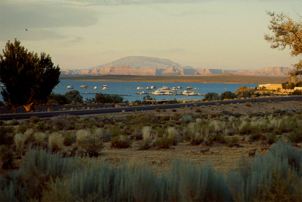
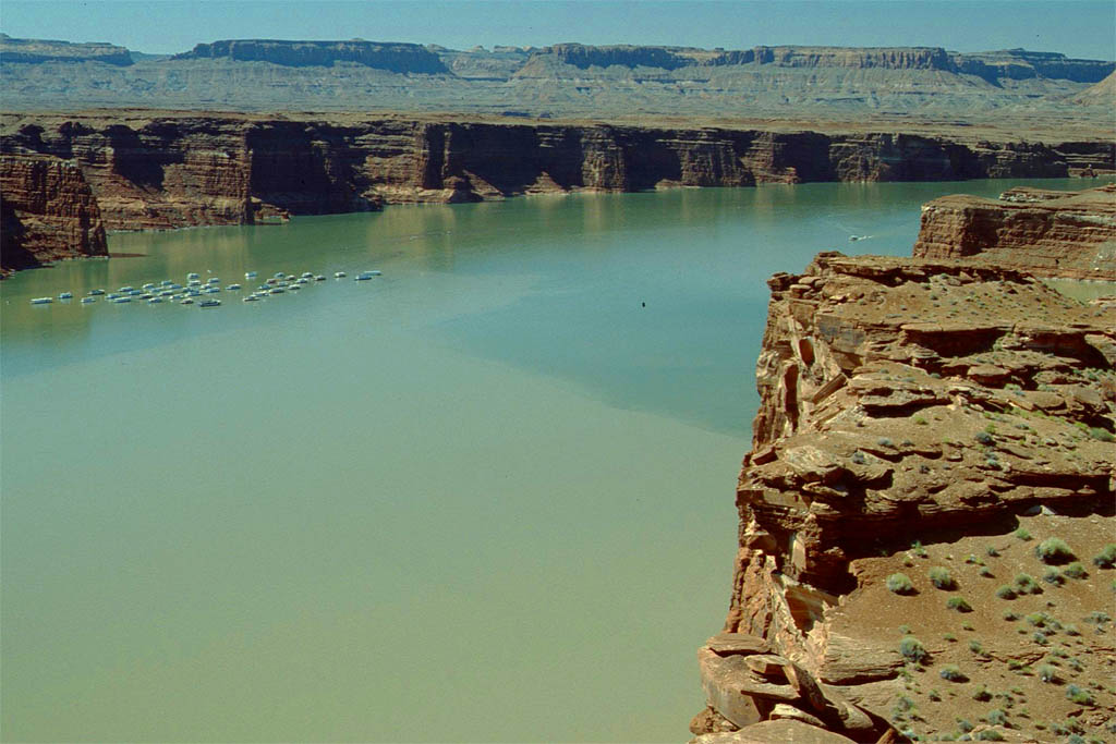
Lake Powell
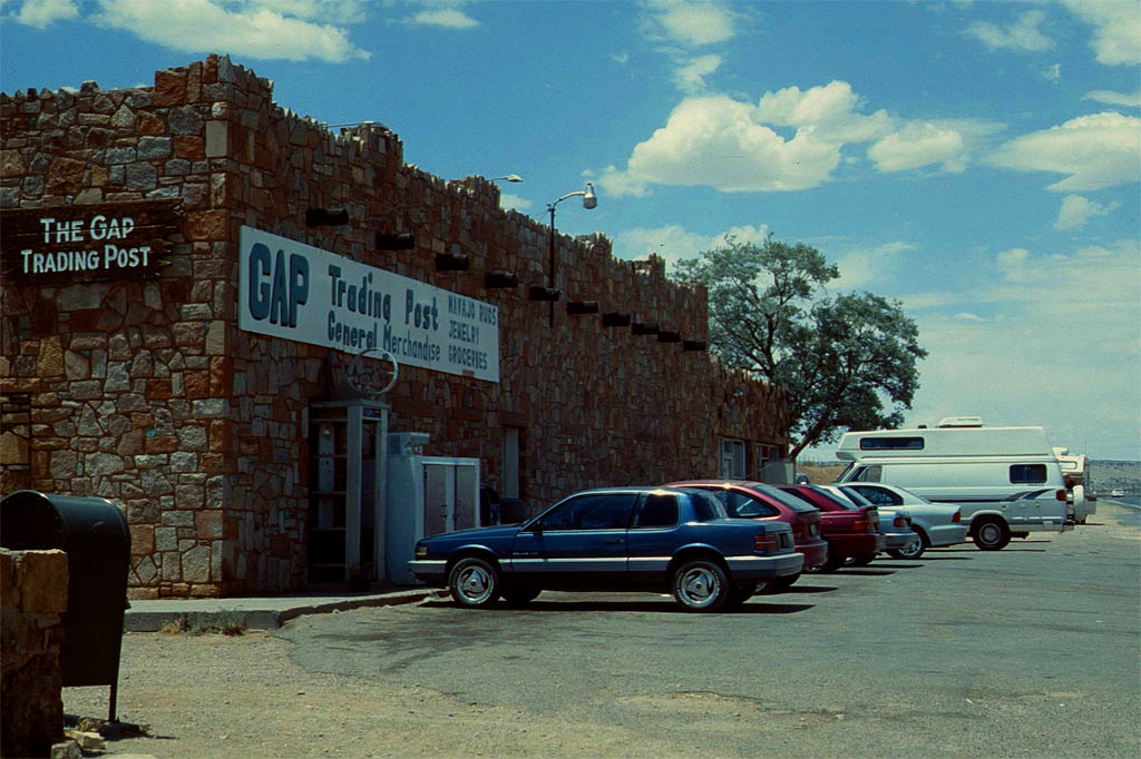
From the Grand Canon we drove back to US-89, the Utah Heritage Highway, to follow it up north to Page amd Lake Powell via Gap. What a nice spot. We didn't park right on the beach already crowded with many other mobil homes. We chose a commercial campground with all the amenities just hundred meters from the lake. So it was just a short walk down to swim in the chrystal clear water.
An excerpt from Wikipedia says that Lake Powell is a reservoir on the Colorado River, straddling the border between Utah and Arizona. It is a major vacation spot that around two million people visit every year.
| Via Gap
|

| Lake Powell
|
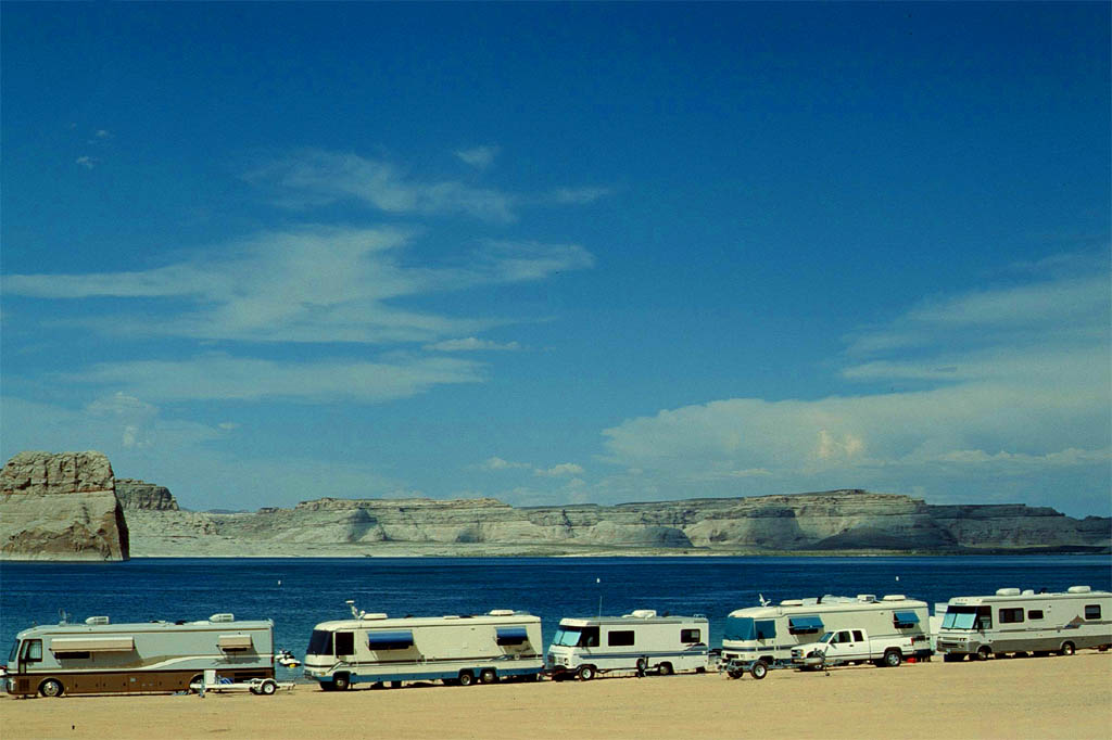
| No much space on the beach for mobile homes
|
| But enough space for people without
|
| This is our lot on a commercial camp ground
|
| Only a little bit away from the beach
|
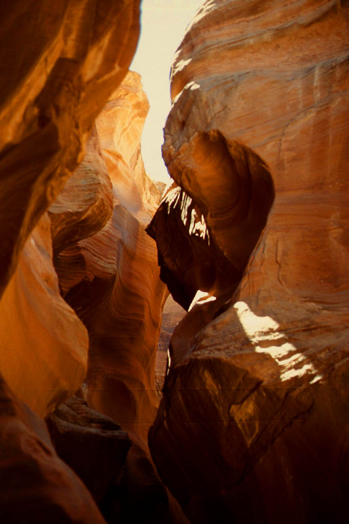
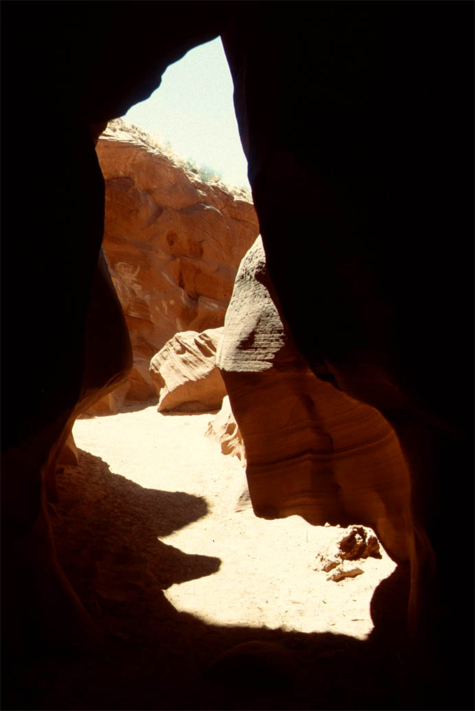
Antilope Cave
Once in Page you must visit the Antilope Canyon. It was formed by erosion, primarily due to flash flooding, which may still occur. So be warned and check the wheather report before you enter. Many people have been killed before by a flash flooding caused by a sudden storm with a lot of rain poring down. The water will rise quickly because of the narrow canyon. This makes it even more fantastic. Take a look at following photos.
| Few greens between the rocks
|

| But this rock has a secret entrance
|
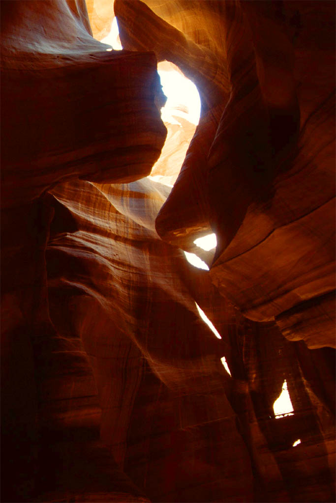
| It's the Antilope Canyon
|
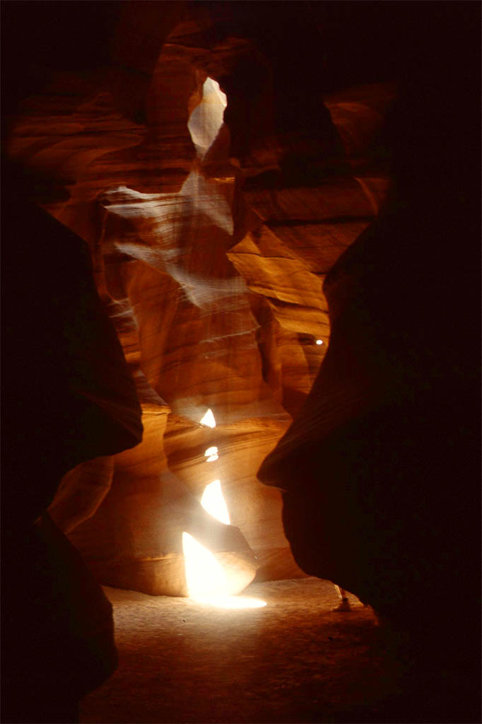
| iluminated by the sun light
|
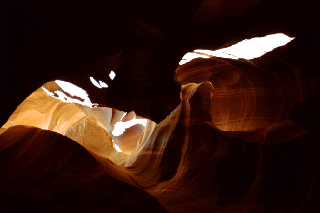
| Openings in the ceiling
|
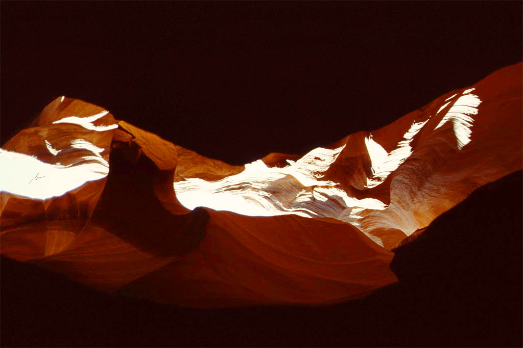
| Where the day light comes in
|

| The walls are formed
|
| by sudden flash floods
|
| It's a photographer's paradise
|

| by throwing up sand for a better effect
|
A ghost town
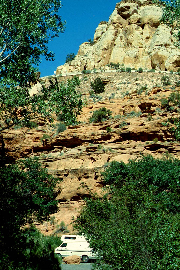
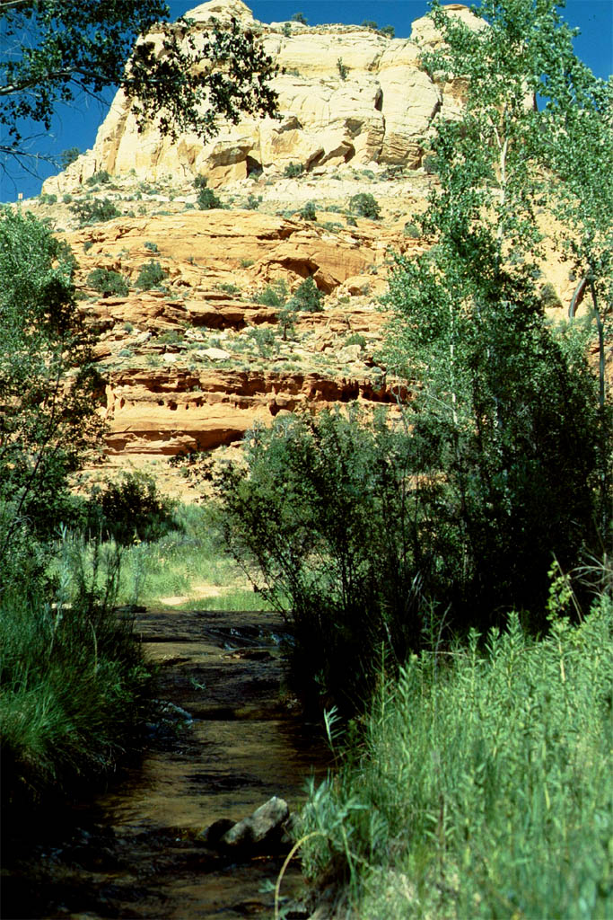
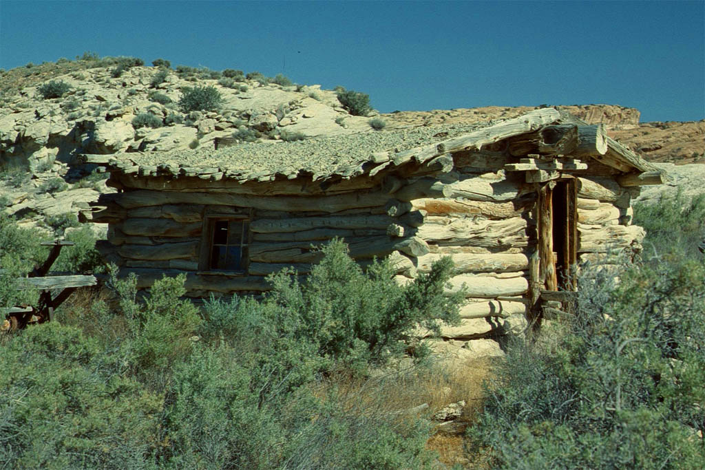
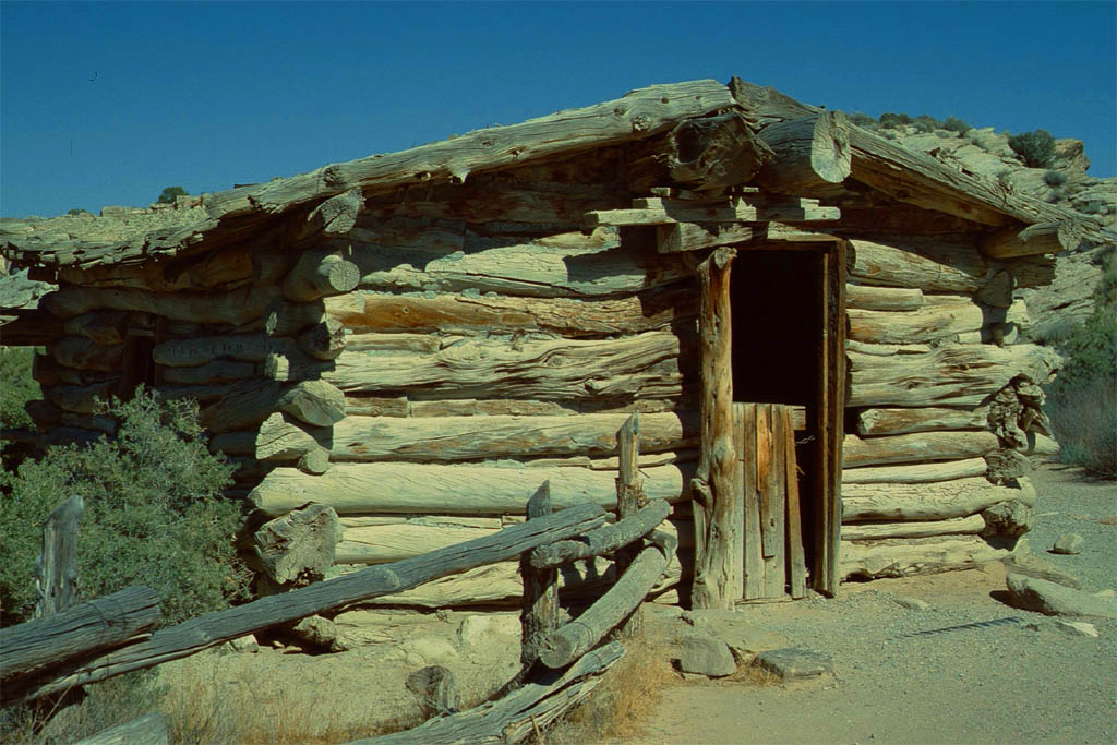
From Page we continued on the Utah Heritage Highway leading us to the Zion National Park. But before we got there we went off the highway and made a detour on a dirt road to visit a ghost town. Actually, the regulation for our rented mobile home says that you always have to stay on sealed roads. But what the heck. I always wanted to see a real ghost town. But that one was a little disappointing.
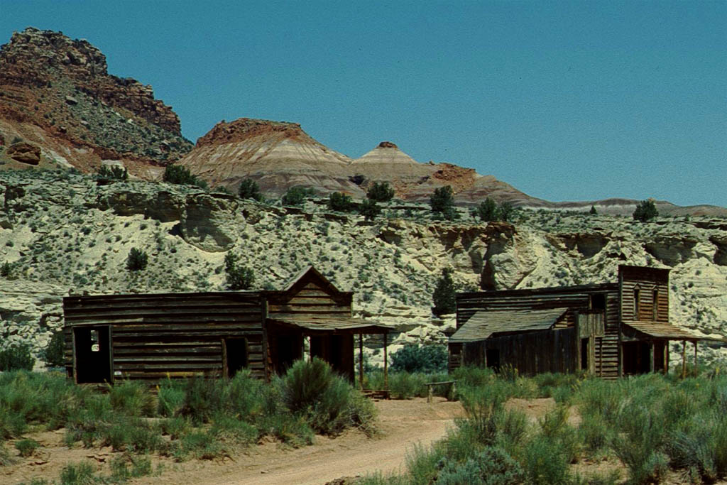
| Next stop
|
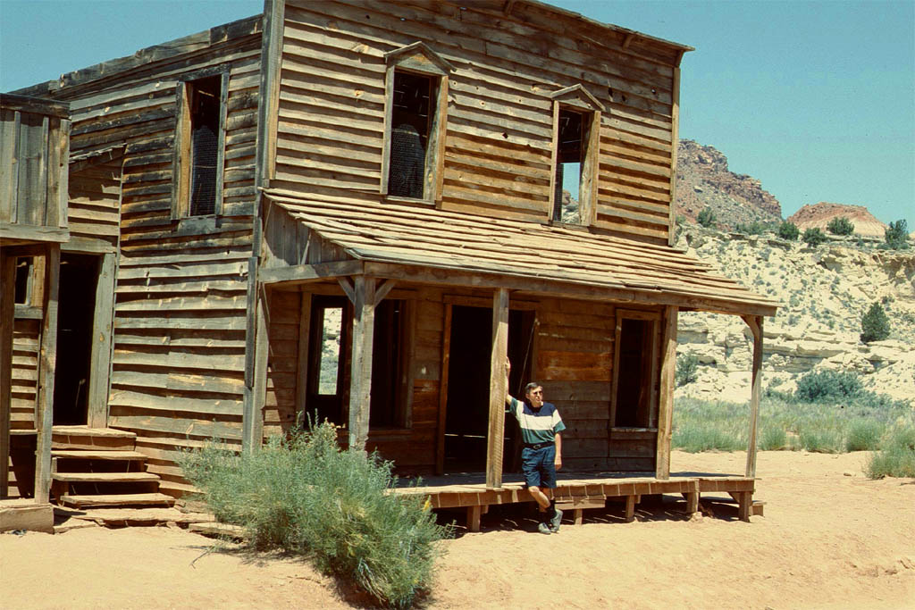
| at a ghost town
|
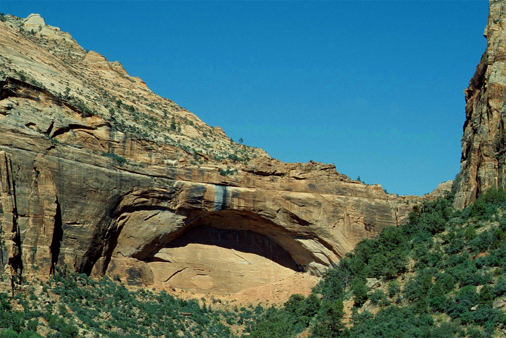
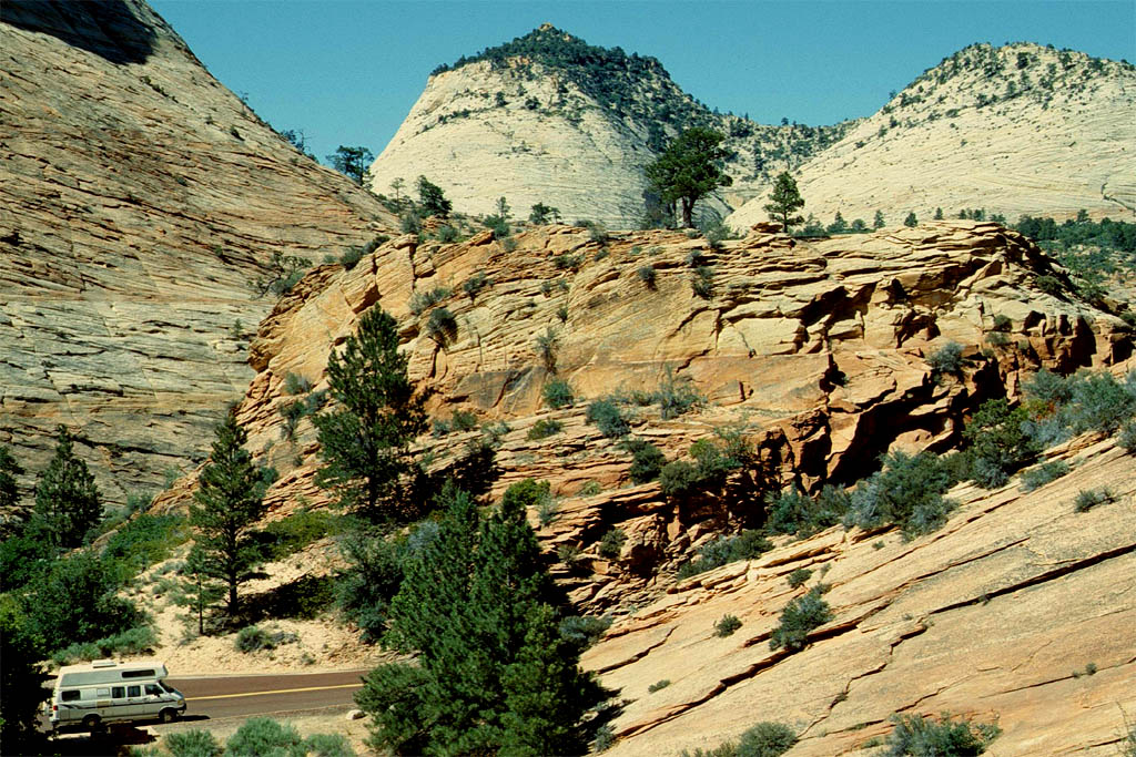
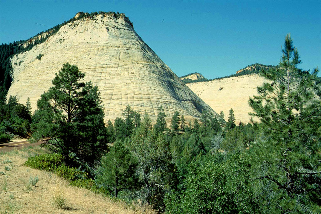
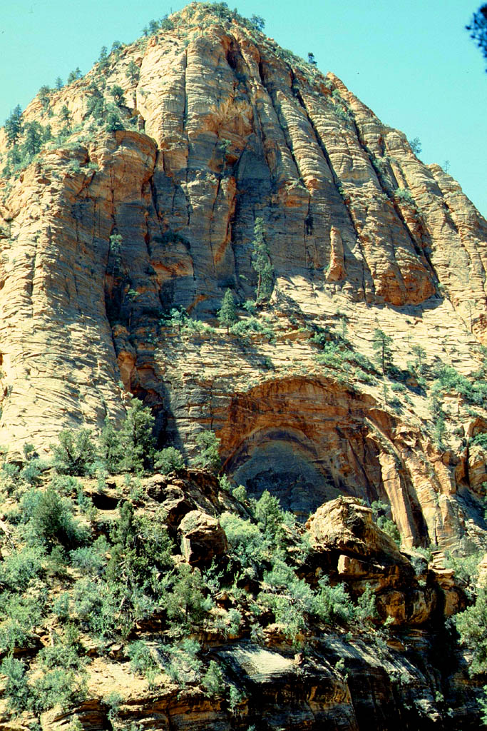
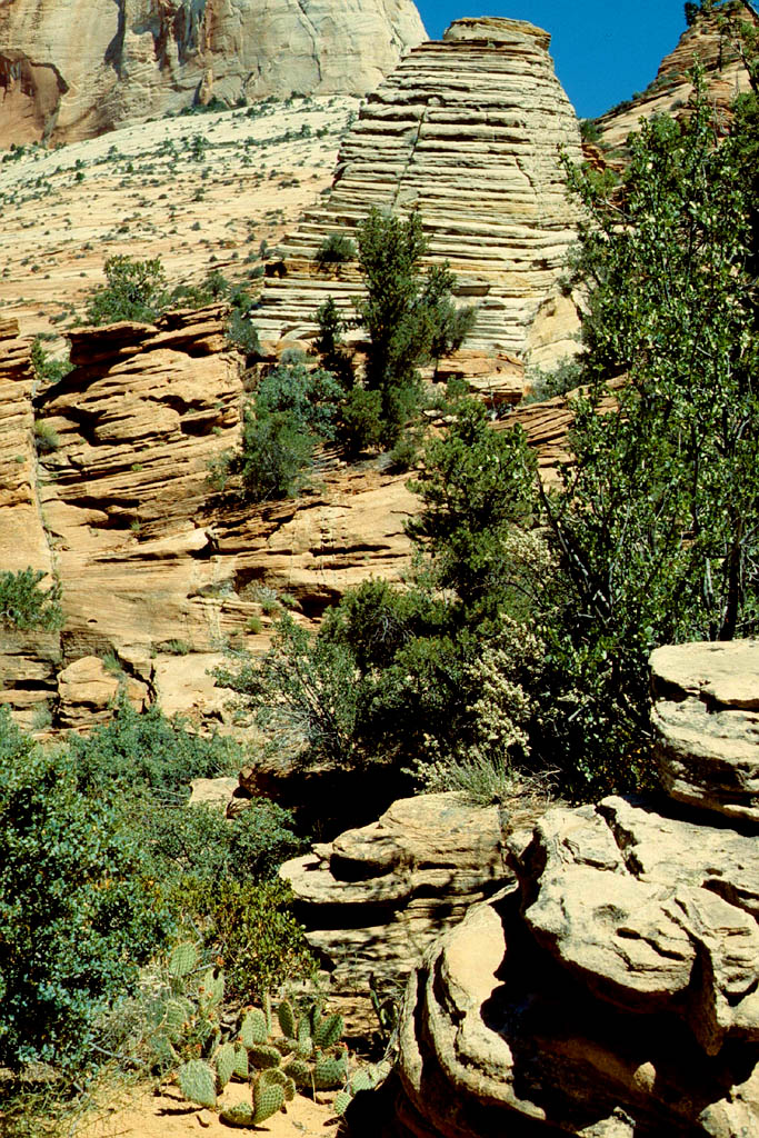
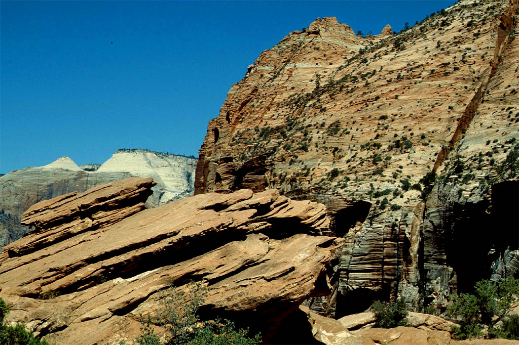
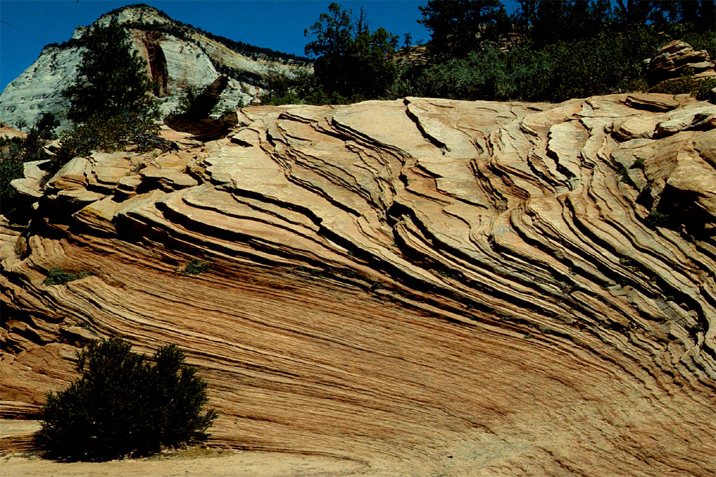
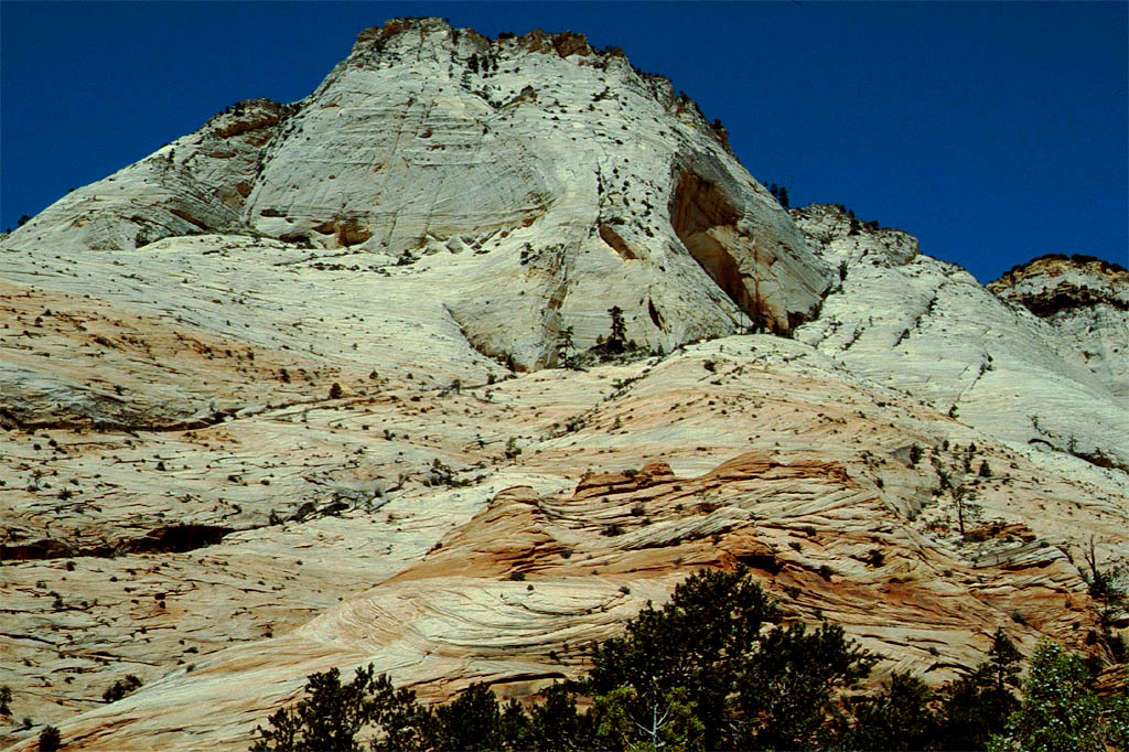
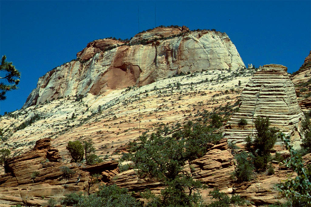
The Zion National Park
Before we entered the Zion National Park we stayed overnight on a campground. Next day we toured all around and between the beautiful landscape. The park has a unique geography and a variety of life zones that allow for unusual plant and animal diversity. It includes mountains, canyons, buttes, mesas, monoliths, rivers, slot canyons, and natural arches. Take a look at following photos to get an impression.
| Then driving through
|
| a fantastic countryside
|
| It's the
|
| Zion National Park
|
| It is not easy to walk around
|
| but here it was all flat
|
| What a fantastic
|
| landscape
|
| Another sight
|
| along the road
|
| Another sight
|
| behind every corner
|

| This Mexican hat slipped somehow
|
| On the way to the Brice Canyon now
|
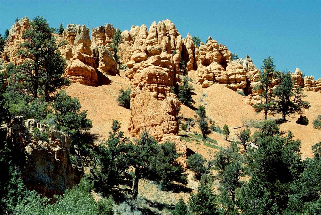
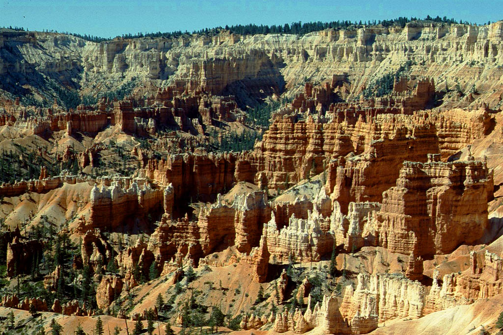
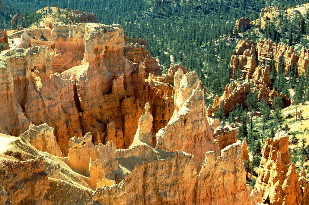
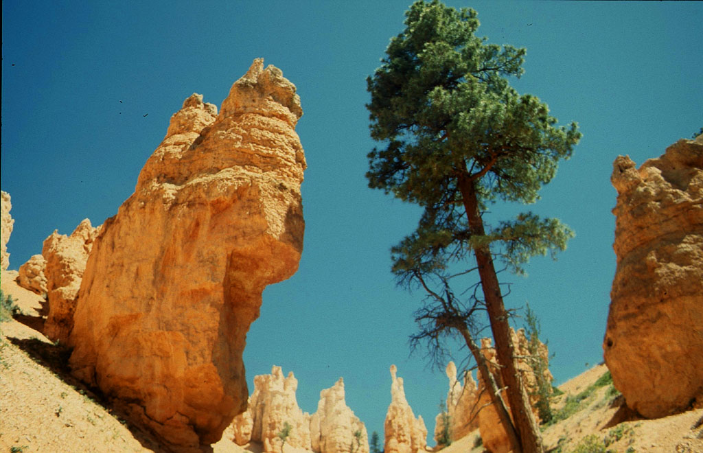
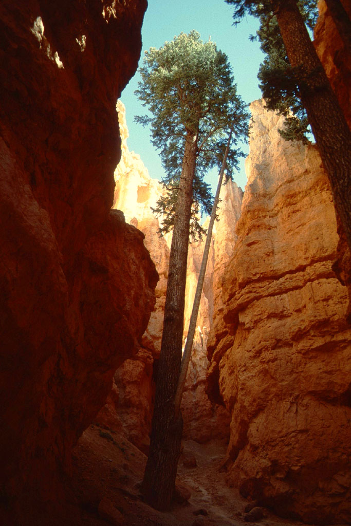
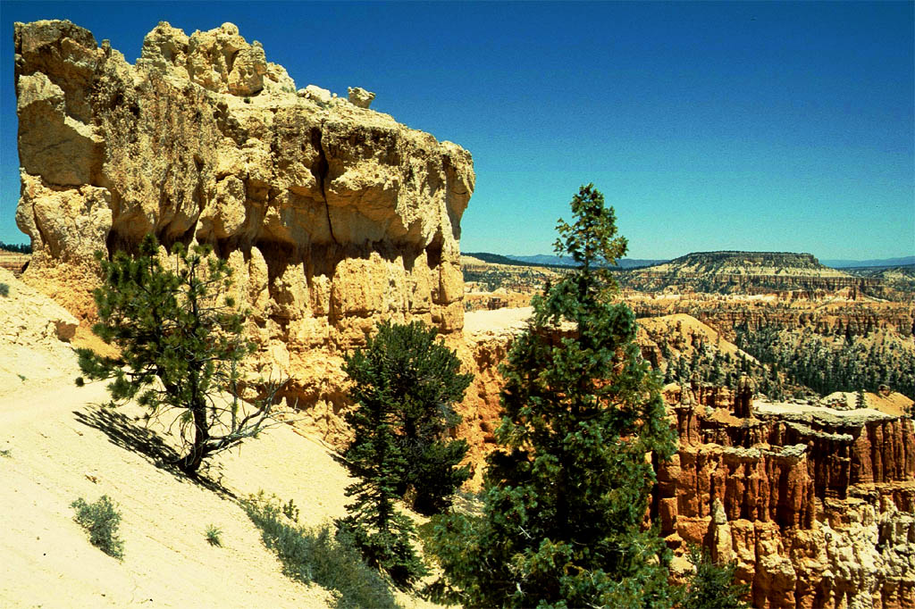
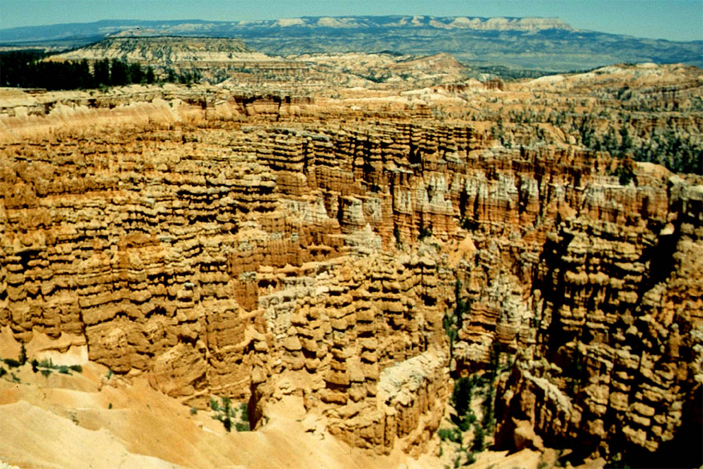
The Bryce Canyon National Park
After the Zion Natoional Park we drove up north to the Bryce Canyon National Park, which is even more impressive. Following is an excerpt from Wikipedia:
"It's known for crimson-colored hoodoos, which are spire-shaped rock formations. The park�s main road leads past the expansive Bryce Amphitheater, a hoodoo-filled depression lying below the Rim Trail hiking path. It has overlooks at Sunrise Point, Sunset Point, Inspiration Point and Bryce Point. Prime viewing times are around sunup and sundown".
| Arriving at
|
| Brice Canyon
|
| What a sight
|
| Wonder of nature
|

| People are so small
|
| A tree reaching for the sun
|

| Who or what
|

| has created all this
|
| Who or what
|
| has created all this
|
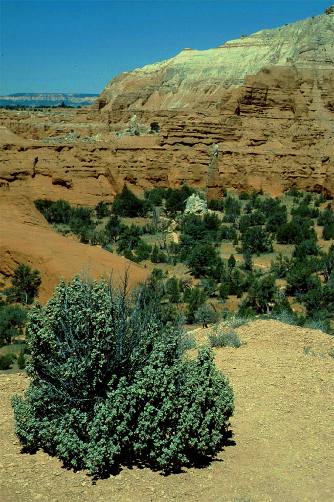
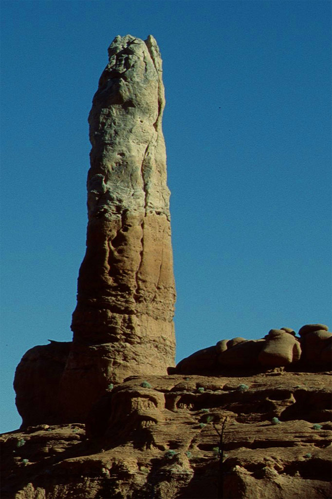
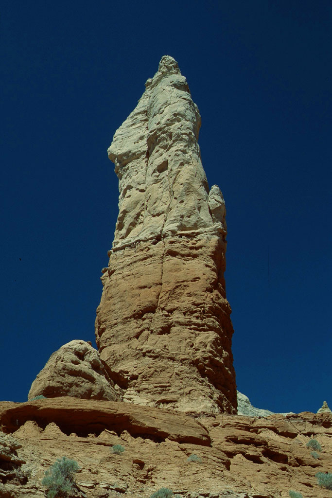
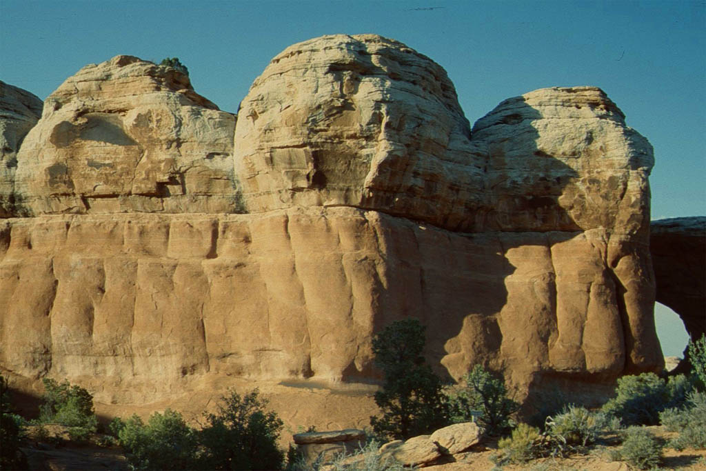
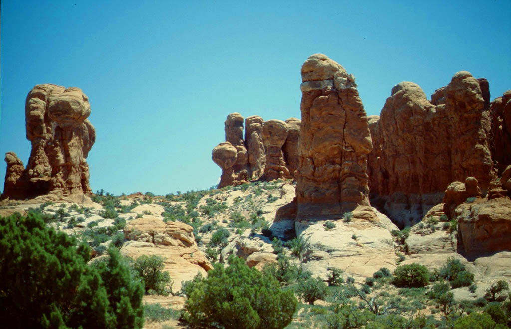
The Kodacrome Basin State Park
Twenty miles southeast of Bryce Canyon National Park we reached the Kadacrome Basin State Park. Following is a description of the Utah Tourist Inormation site:
"The scenery is splashy here, dominated by 67 monolithic stone spires called sedimentary pipes. They accentuate multi-hued sandstone layers revealing 180 million years of geologic time. The color and beauty found here prompted a 1948 National Geographic Society expedition to name the area Kodachrome after the popular color film"
We stayed on a campground just right in the middle. Unfortunately it was infested with thousands of flys bothering you while kreeping all around your face. The only way to escape them was walking up the rocks or staying inside the mobilhome.
| On the way
|
| to the Kodacrome Basin State Park
|

| Looking for a camp ground
|

| in this interesting park
|
| Many sedimentary pipes
|
| sticking out everywhere
|
| Walking around
|

| and climbing up for a better sight
|
The Calf Creek
Next was such a better place to stay than the Kodachrome Basin. We settled down there just right at a small creek. I lied down in it and had the clear water rinse over my body. There was another opportunity to take a bath. That was walking to the waterfall and swimming in the pool in front of it.
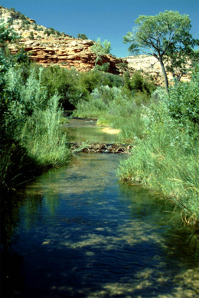
| The idyllic Calf Creek close to Escalante
|
| where we settled down beside
|
| We followed the creek
|
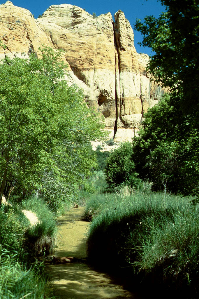
| winding between rocks
|
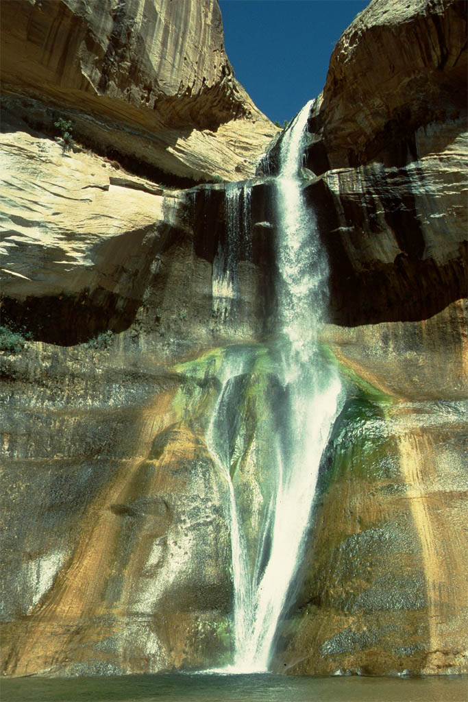
| until we did get
|
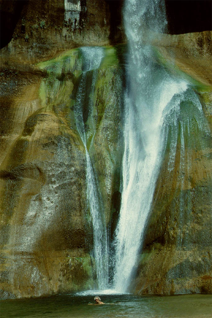
| to the waterfall
|
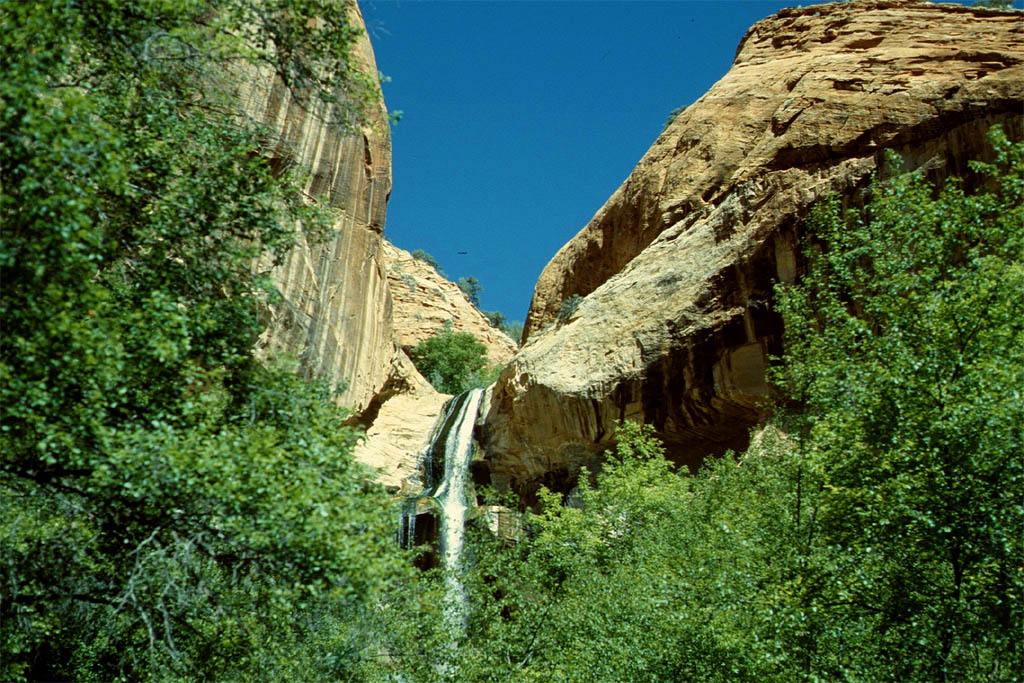
| Nice surrounding
|
| and refreshing
|
From Calf Creek to Hite
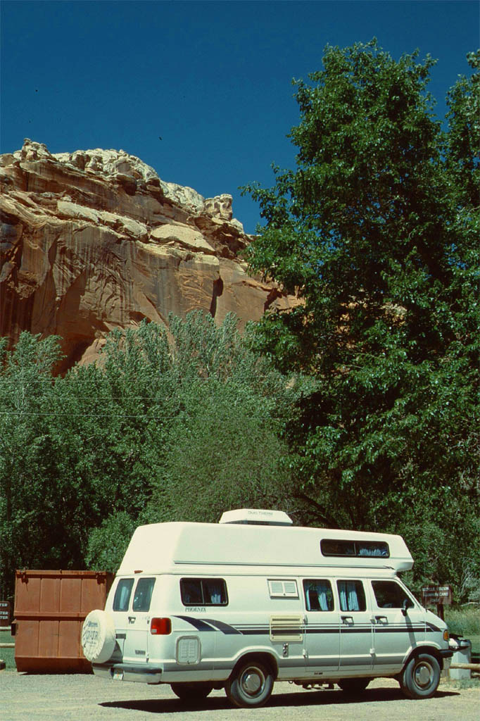
From the Calf Creek we drove first up north following the highway 12 until we reached Torrey. There we changed to the state route 24 going east until we reached the state route 95 at Hanksville. From there we went down south until we did get to Hite at the north end of Lake Powell. Take a look at following photos of what we saw on the way.
| An old Anasazi dwelling on the way
|
| but no place for us to stay
|
| Better is a campground
|
| for the night
|
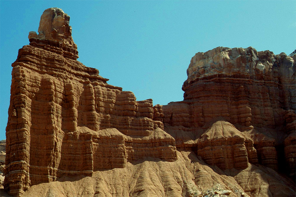
| Passing by fantastic rock formation
|
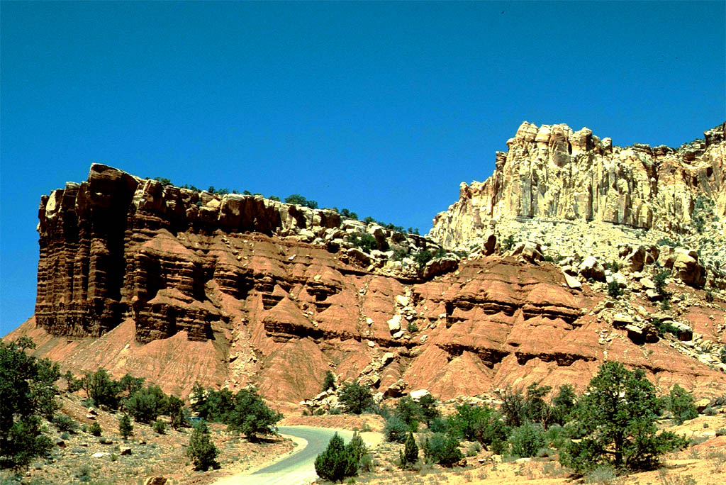
| of the Capitol Reef National Park
|
| Just a stop-over
|
| close to the river
|

| Then e saw an old Ford
|
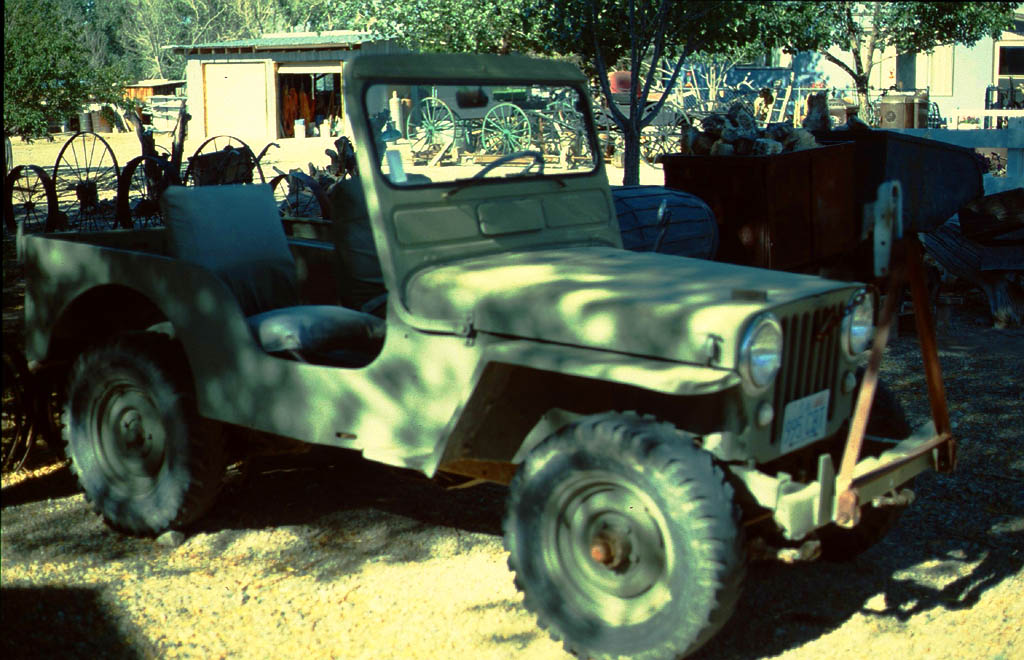
| and an old Jeep
|
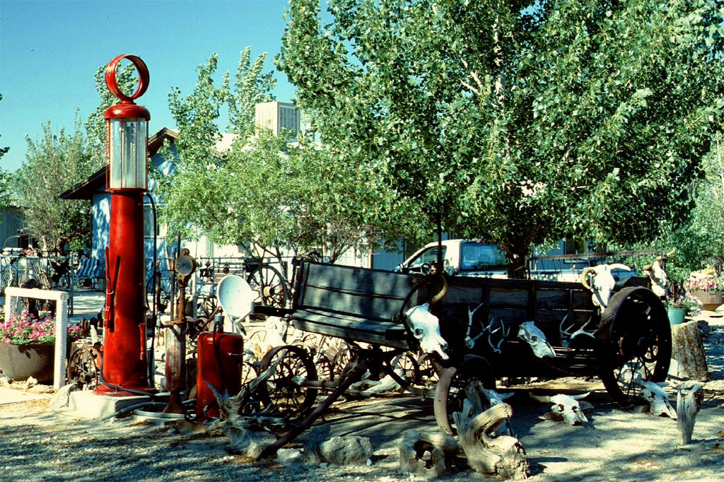
| But no gasoline at this old station anymore
|
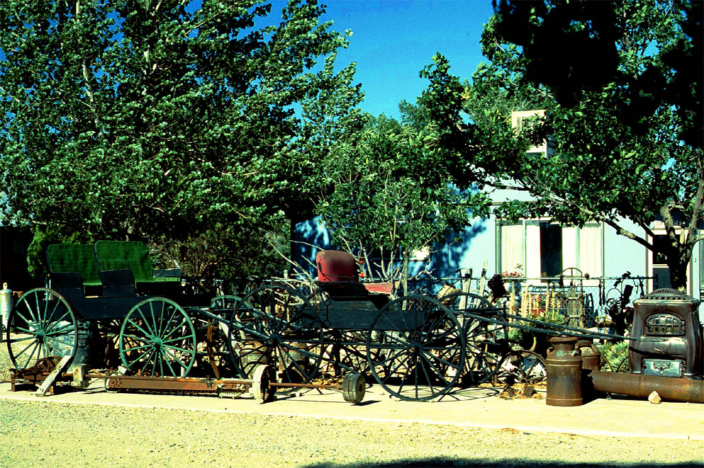
| Maybe you can still use old horse carriages instead
|

| These old harvesting machines
|

| and the tractor may not in operation either
|

| We didn't stay at this motel but filled up gas at Taxaco
|

| and continued to the north end of Lake Powel
|

| Where we crossed the bridge at Hite
|
| and we had a fantastic view (house boats in the middle)
|
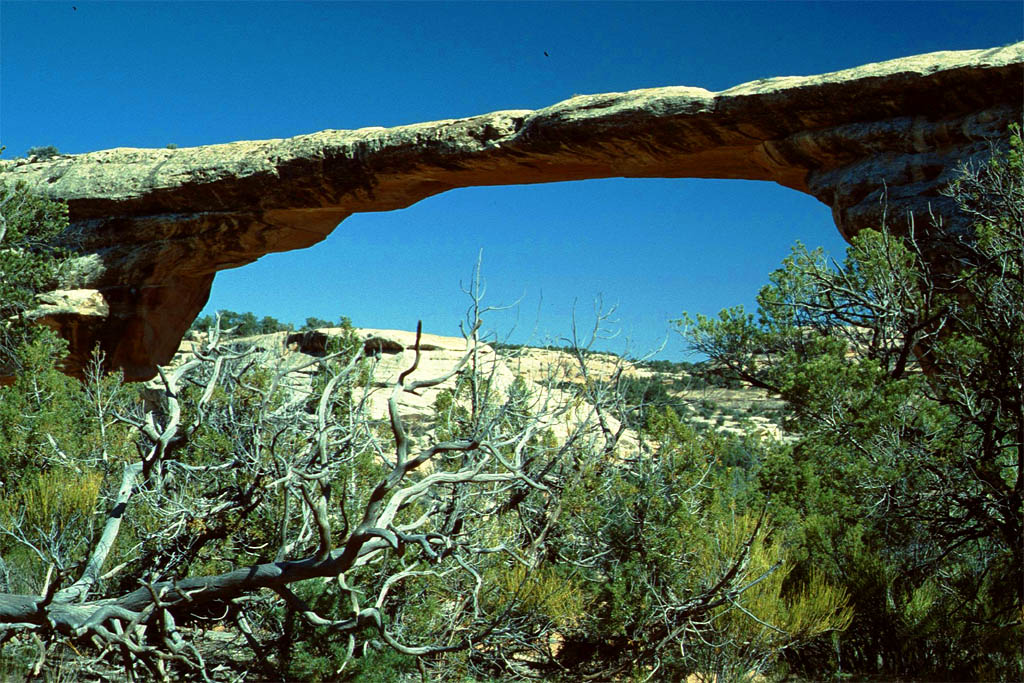
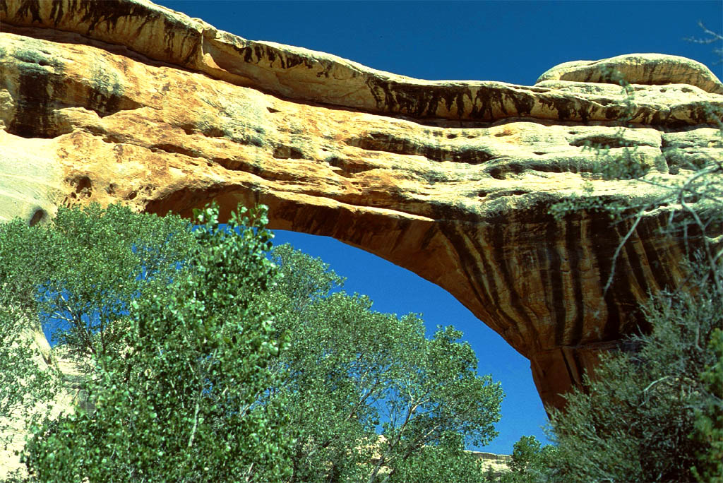
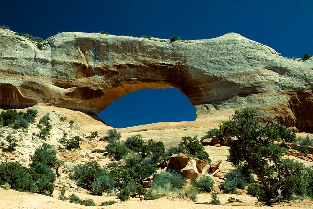
Natural Bridges National Monument
South of Hite we drove through the Natural Bridges National Monument. Following is an excerpt from wikipedia:
"The three bridges in the park are named Kachina, Owachomo, and Sipapu (the largest), which are all Hopi names. A natural bridge is formed through erosion by water flowing in the stream bed of the canyon. During periods of flash floods, particularly, the stream undercuts the walls of rock that separate the meanders (or "goosenecks") of the stream, until the rock wall within the meander is undercut and the meander is cut off; the new stream bed then flows underneath the bridge. Eventually, as erosion and gravity enlarge the bridge's opening, the bridge collapses under its own weight. There is evidence of at least two collapsed natural bridges within the Monument. "
| This bridge should not be crossed
|
| Because we are in the Natural Bridges National Monument
|
| More bridges, thick
|
| and thin
|
| More bridges, small
|
| and twisted
|
| More bridges, double hole
|
| double high
|
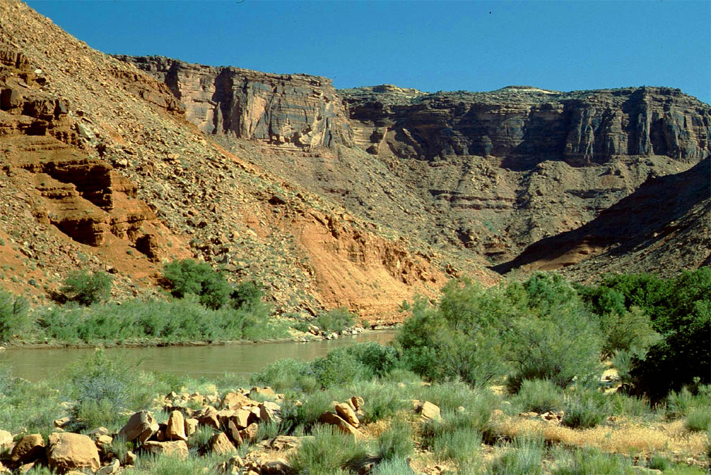
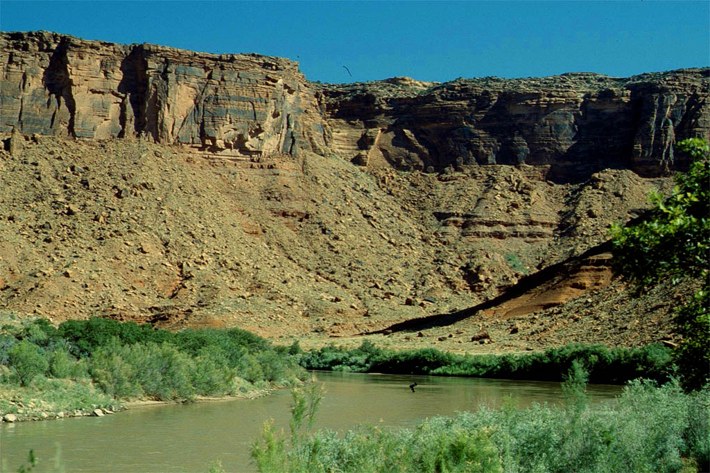
On the way to Moab
We continued on the state route 95 until we hit highway 191 at Blanding. That is not far from Bluff just 11 miles south, which we passed before on the way to the Grand Canyon. But now we drove to Moab up north. Take a look at following photos of what we saw on the way.
| There are many strange rocks
|
| with some trees for decoration
|
| This looks like an Indian fortress
|
| and this like the tiger of Singapore
|
| Who is living here?
|
| Knock the door and Davy Crockett will appear
|
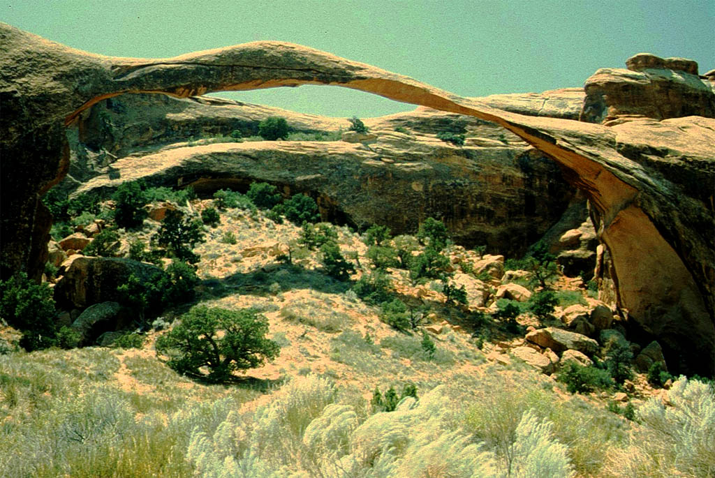
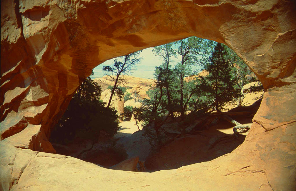
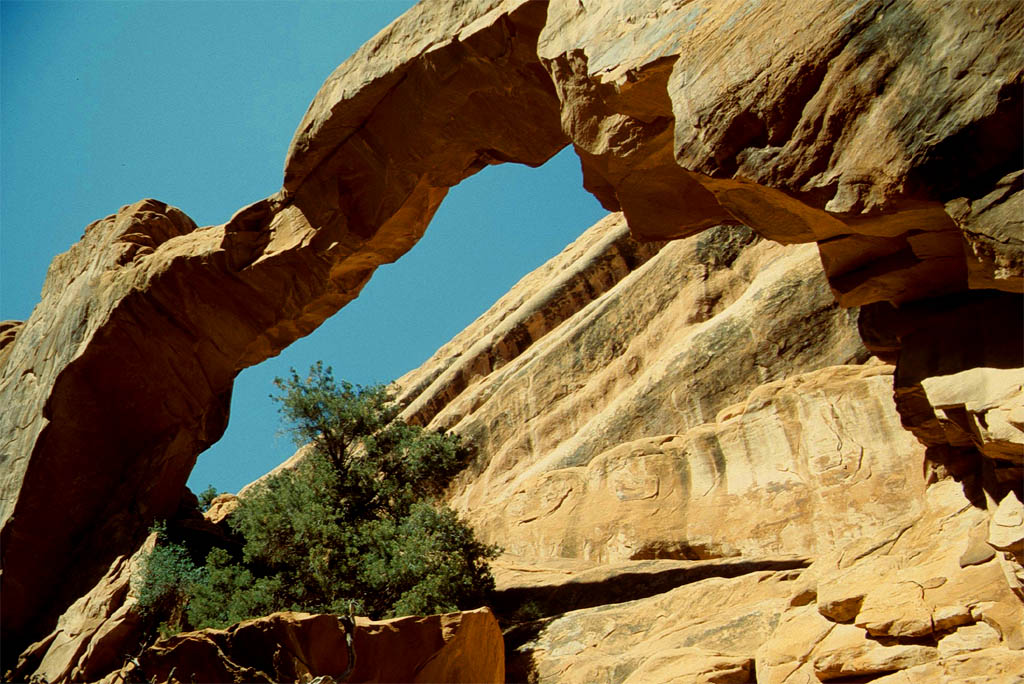
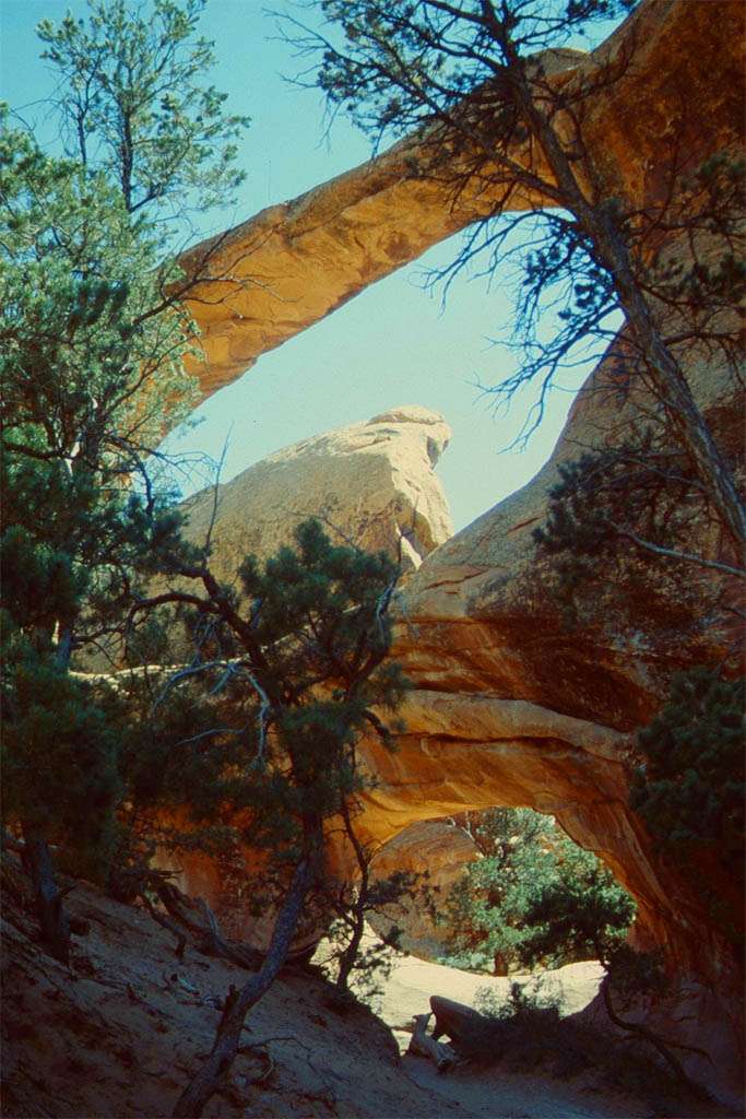
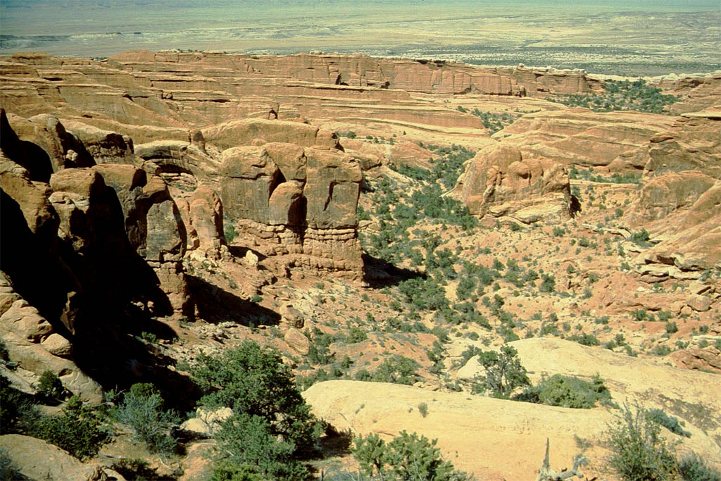
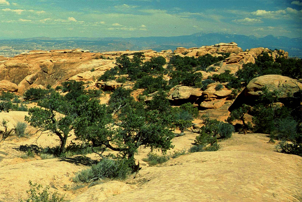
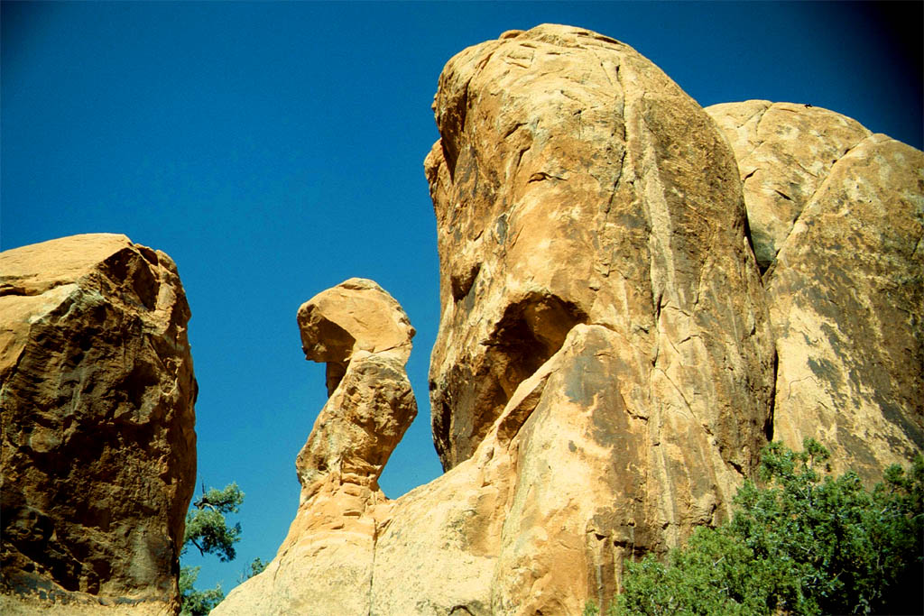
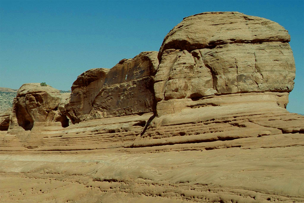
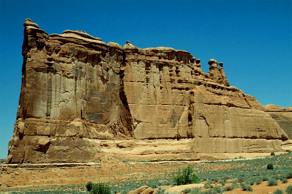
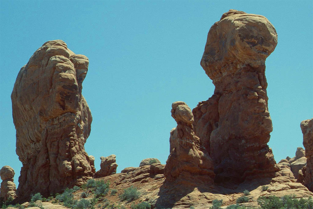
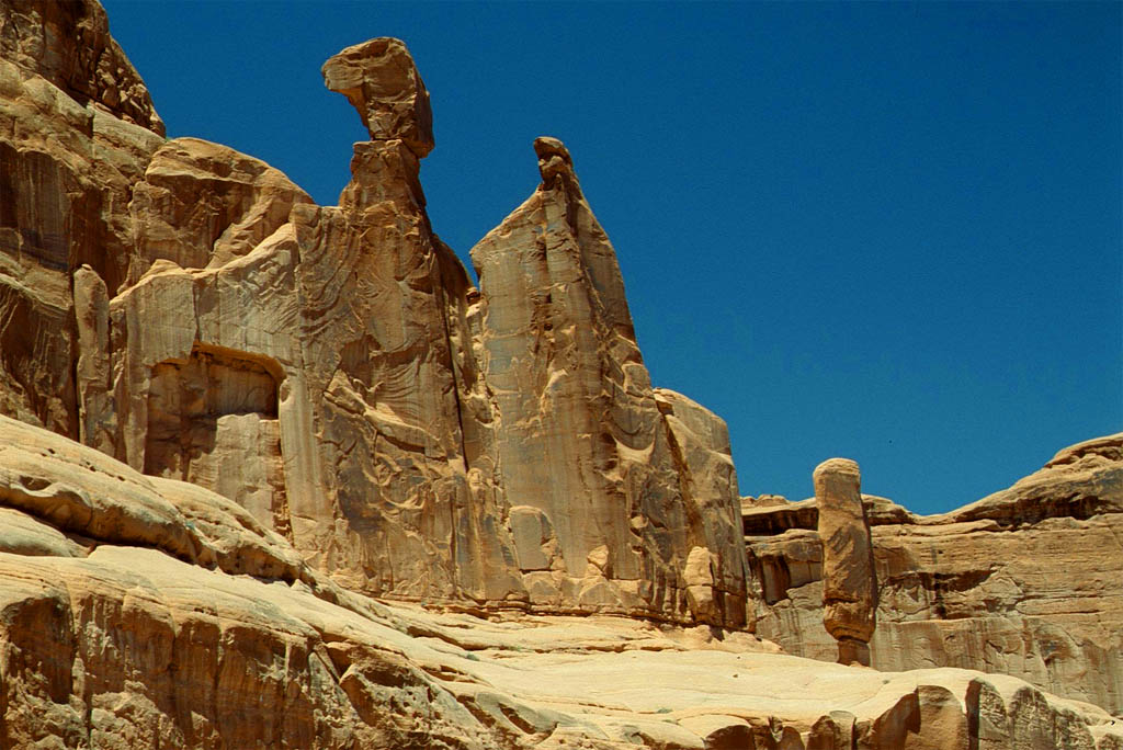
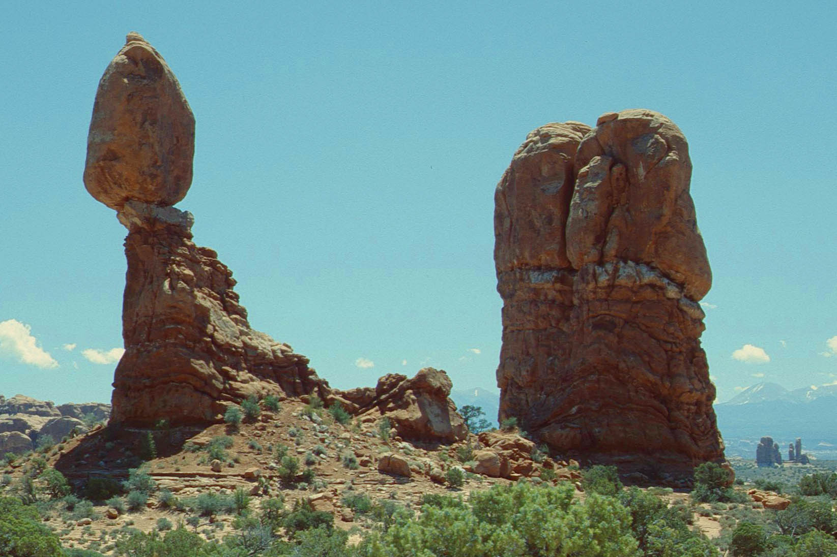
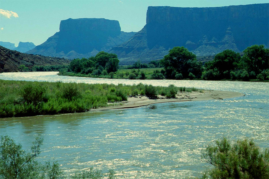
Arches National Park
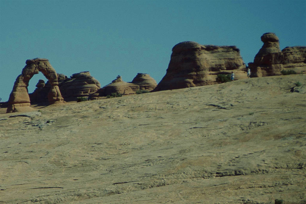
Four miles north of Moab starts the Arches National Park. It has 2,000 natural sandstone arches including the world-famous Delicate Arch. We settled down at a nice campground in the middle of it. It was fantastic to walk around and inspect these wonders of nature.
| Finally we are in the Arches National Park
|
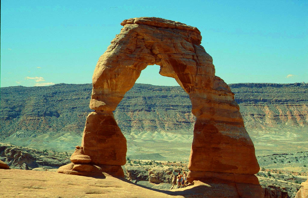
| with the most famous Delicate Arch
|
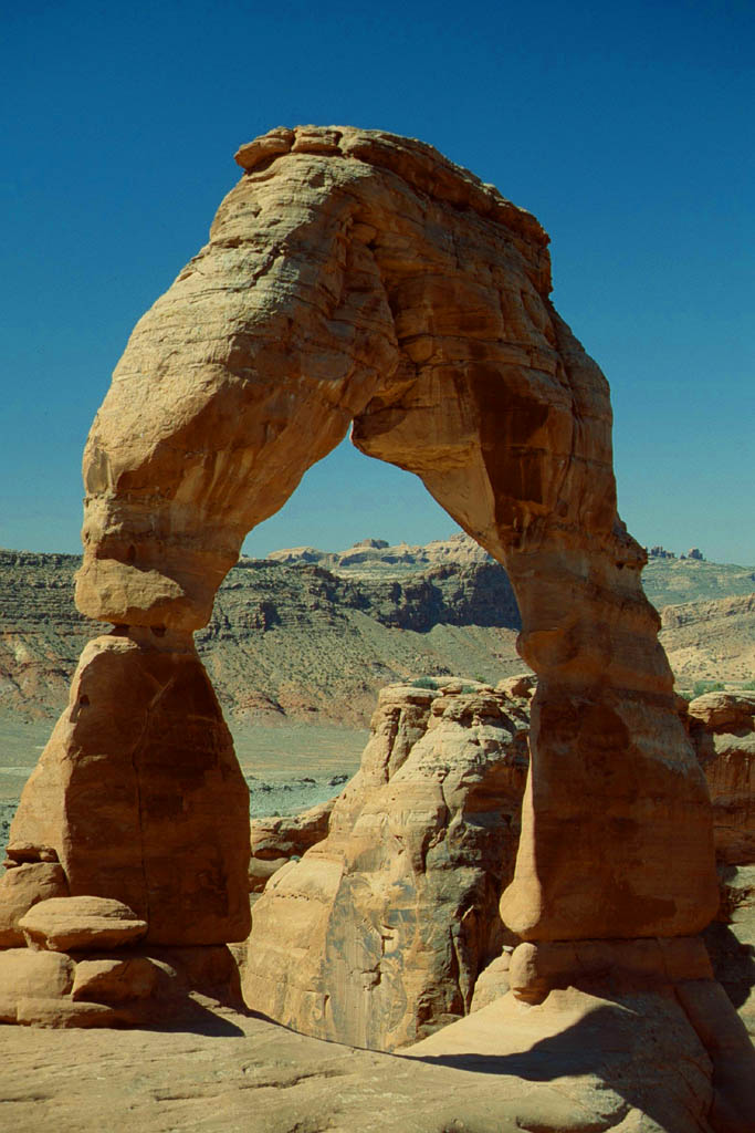
| It is looking small
|
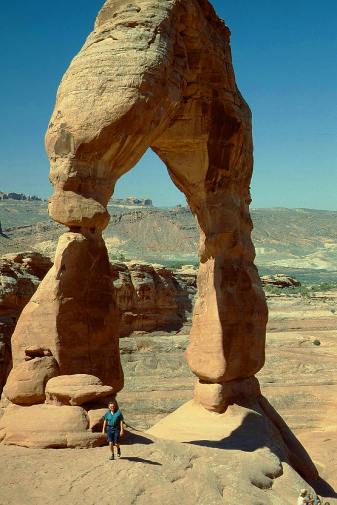
| But it is me who is small
|
| Another small arch
|
| Colosses of stone in between
|
| Doesn't it look ike a temple in Karnak
|
| And these look like the Colossi of Memnon
|
| A head of a Pharao and inscription below?
|
| Can you see the monster, elephant and alien?
|
| More strange sculptures
|
| Who could have created that
|
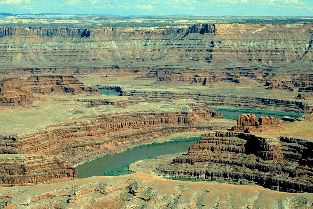
Driving back to Denver
From the Arches National Park we drove along the Colorado River until we reached the Interstate 70 on which we continued until we reached Denver with a stop-over in a mountain resort on the way. I do not remember the place, but must have been a famous one beause the campgrounds close-by were all full. Because of the well organized Americans we were directed to another one by rangers farther away which had vacant lots.
| We continued our trip
|
| but did we really passed this?
|
| Now I remember it again
|
| This is the Colorado River again
|

| Yes, we followed it
|
| until the Interstate 70 we hit
|
 Copyright C 1997 by Rand McNally
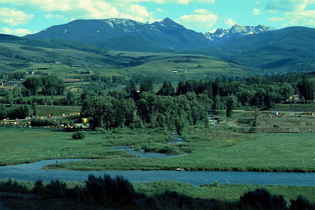
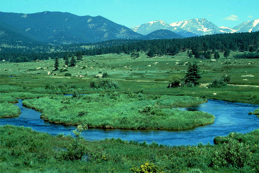
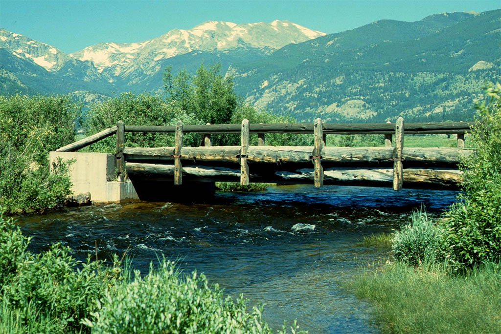
Since we had a couple of days left before our flight back to Germany (always the contingency at the end of the trip in order not to miss the plane), we drove up to Estes Park, also a famous tourist spot where we stayed overnight at a commercial campground. The country side to get there and around was breathtaking. Take a look at the following photos.
i
| This is not the Colorado River
|
| but we are back in the State of Colorado
|
| This is a wild country
|
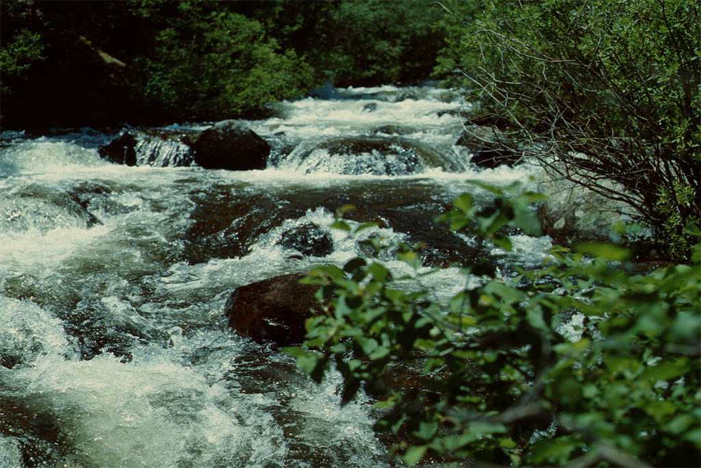
| with wild rivers
|

| Looking at
|
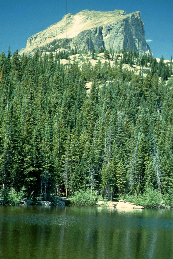
| the Bear Lake
|
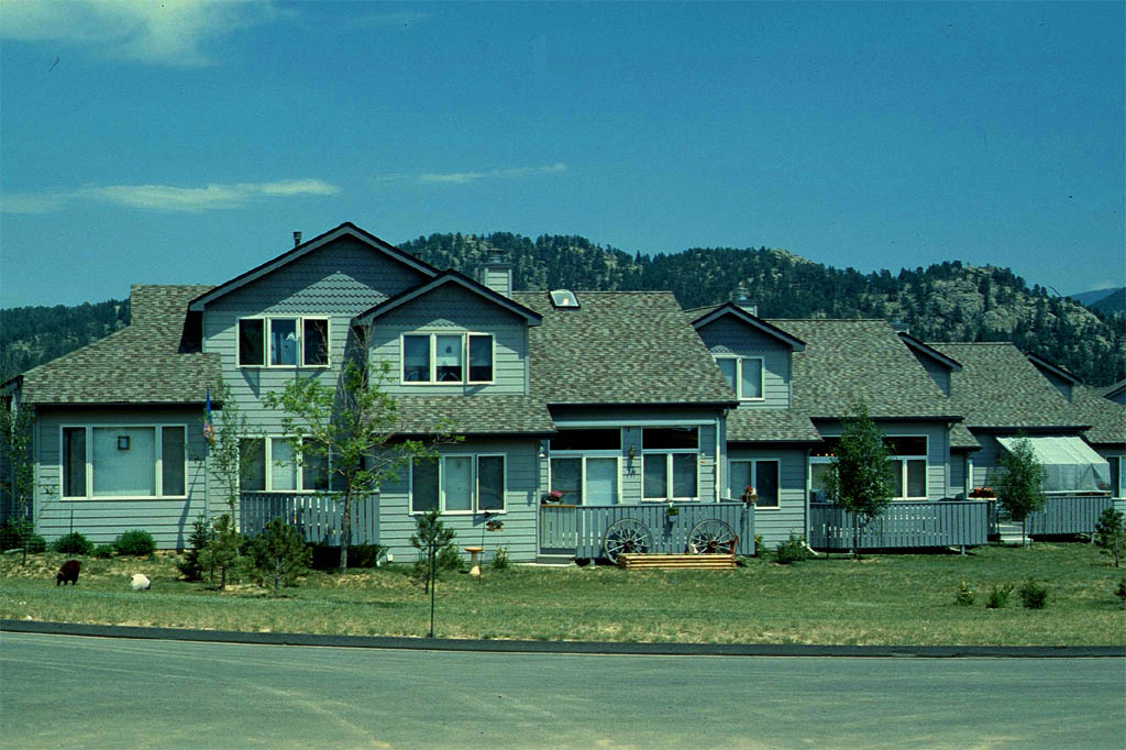
| Like to stay here and buy a house in Estes Park
|
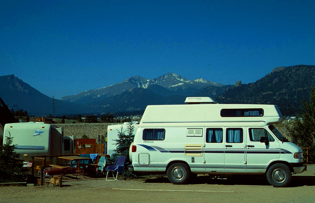
| Better just temporarily to stay on a camp ground
|
Ok, that was our trip to the USA, though only a very small part of it. I could have seen and done a lot more. Also I could have written more. If you want to know more all about the places I have visited, then just look up any of the many guidebooks or in the internet.
| 
